
14 September 2026

Owing to their sheer natural beauty, the Himalayas have always had a way of capturing the imagination of travellers. Particularly, the last decade has seen Uttarakhand’s trekking base camps emerge as highly sought-after destinations in their own right.
A trekking base camp is essentially a starting or staging point for reaching a major mountain, high pass, a prominent summit, or remote area. In the Himalayas, it serves as a hub where trekkers stop, organize themselves, rest, and prepare for the actual trekking journey ahead.
The base camps are usually located on the fringes of human settlements, beyond which the Himalayas reveal their raw side, and wilderness takes on its true meaning. In other words, the launching points from where trekkers encounter nature in its purest form.
But it begs a cardinal question here: why exactly is it called a “base”?
Suppose a group of trekkers want to climb a difficult mountain peak, and the journey doesn’t seem anywhere near comfortable. Then, at a certain place, they will need to:
Thus, a base camp is not simply a foothill or “bottom of a mountain system”. It’s a strategically selected place that is safe, accessible enough for supplies, and suitable enough for acclimatization and logistics.
Today, several villages and mountain towns have emerged as prominent trekking base camps, including Natin, Sankri, Pipalkoti, Lohajung, and Sari.

Over the last few decades, trekking has driven a profound shift: rural economies and local communities are reaping direct and indirect benefits. In this regard, Himalayan trekking contributes to reverse migration by transforming mountain landscapes into sources of employment and entrepreneurship.
Migration from Uttarakhand’s mountain villages has been a major social and economic concern. Difficult terrain, limited employment opportunities, inadequate access to markets and education, and the challenges associated with mountain agriculture have encouraged many working-age residents to move towards towns and cities.
The Rural Development and Migration Prevention Commission of Uttarakhand describes rural out-migration as a serious problem, noting population decline and depopulation in parts of the hill districts.
Trekking is generating jobs such as:
This is important because lack of employment is one of the main reasons young people leave Himalayan villages. According to MDPI research, villages with seasonal tourism opportunities are likely to retain more population than those with fewer livelihood options.
Even people living in big cities are understanding the potential of trekking, as they are investing in businesses such as homestays, cafés, transport services, trekking agencies and rental businesses. And due to this impact, several businesses get supported at once. Trekkers need accommodation, food, transport, guides, porters and supplies. Thus, one trekking route can create a local economic chain.
There has been a noble start by the Uttarakhand Tourism Development Board. It is promoting rural tourism and homestays as mechanisms for bringing tourists into remote areas while creating additional income for local families. It recognizes the potential of rural accommodation to generate self-employment.
Thus, from that perspective, trekking is no longer only about reaching a summit or a spectacular viewpoint. It immensely supports the communities that make access to these landscapes possible. And this is where the Himalayan base camps are proving their worth.
They are becoming instrumental in instilling entrepreneurship among youth. This is significant in terms of reducing migration and encouraging reverse migration. One more thing: when people return, they are more likely to repair houses, reopen shops, maintain farmland and participate in village institutions. This revitalizes and transforms the villages tremendously.
Here are some of the most prominent base camps in Uttarakhand, one by one:

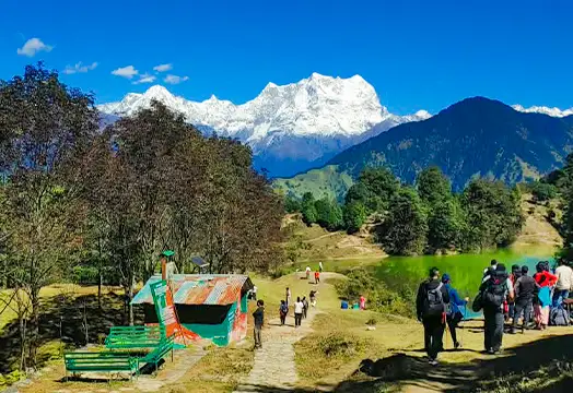
Located in Uttarkashi district, Natin is a small and picturesque Himalayan village. It’s a prominent base camp for Dayara Bugyal and Surya Top treks. Dayara is one of Uttarakhand's celebrated high-altitude meadows. As per the district administration, the meadow landscape begins around 2,600 meters and extends up to 3,600 meters, with forests and rhododendron-covered sections. The landscape of Natin is not merely scenic; it has historically been part of a larger mountain environment.
Just like typical Garhwali villages, Natin’s culture has traditionally been shaped by altitude, seasons, agriculture, and access to natural resources. As terraced cultivation is an important livelihood activity here, fields have to adapt to steep slopes, water availability, and changing weather conditions. Thus, livestock, seasonal work, and agriculture are a major part of its economy.
In Uttarakhand villages, there is paramount importance of relationships and local religious traditions. In Natin too, festivals and ceremonial gatherings are an important expression of collective identity. One of the most distinctive examples is the Andhudi or Butter Festival, celebrated at Dayara Bugyal meadow. Villages from Natin and neighbouring settlements participate in this celebration associated with Lord Someshwar. Milk, curd, and especially butter are an integral part of the celebrations, much like the colours of Holi.
The lower village areas consist of cultivated slopes and forested sections. As you move higher, the forests give way to the expansive meadows of Dayara. In summer, the bugyal becomes a vast green carpet; in winter, snow transforms it into a completely different world.
The wider region is rich in biodiversity. The wildlife of this region includes the Himalayan Monal, black bear, and barking deer. Forests of oak and rhododendron provide habitat for birds and wildlife, while the high meadows serve as grazing grounds.
The beauty of Natin, therefore, lies in its transition—from inhabited village landscape to forest to open alpine meadow. Therefore, it is precisely this transition that makes this base camp’s experience valuable.

If there is a village in Uttarakhand that has become synonymous with trekking, it has to be Sankri. Located at an altitude of roughly 1,920 meters, Sankri is surrounded by the forests and mountains of the Tons Valley region. The village lies right on the edge of Govind Pashu Vihar National Park and Sanctuary.
Sankri is famous for apple orchards with a rich history of tourism. It has a busy market with a significant number of hotels and restaurants for tourists. The majority of shop owners are involved in trekking-related businesses. Sankri also attracts travellers who want to experience snowfall during winters. It serves as the starting point for several famous treks, including Kedarkantha, Har Ki Dun, Bali Pass, and Phulara Ridge.
Some of the homes in this village still retain elements of traditional Himalayan architecture. Certain wooden houses and temples display intricate craftsmanship of the ancient era. The region's cultural traditions are closely tied to its mountain environment, local deities and agricultural communities.
The Tons Valley region is very crucial from a cultural perspective because its remote geography has helped preserve unique customs, village traditions, and architectural crafts. Simply walking through Sankri offers a profound cultural experience. Terraced fields, local temples, shops, traditional food, and the overall ambience create a typical Himalayan atmosphere.
Sankri’s economy heavily depends on adventure tourism. Local residents work as guides, porters, drivers, cooks, homestay operators and suppliers for trekking groups. Guesthouses and small accommodation facilities have also expanded as the number of trekkers visiting the region has grown.
The Sankri Village is strongly connected and deeply rooted in its ancient traditions, local deities, seasonal festivals, and folk music. In fact, the whole region preserves its distinctive traditions. Its cultural heritage is often linked with the legends of the Mahabharata, particularly in villages like Osla and Saur.
These traditions and cultural roots add another spiritual dimension to popular treks such as Har Ki Dun. Trekkers don’t just walk through empty wilderness; they also move through a cultural realm that has been inhabited and cultivated by Himalayan communities for generations.
The Sankri Village lies in the territory of Govind Ballabh Pant Wildlife Sanctuary, and features a distinct combination of deep river valleys, dense alpine forests, and stunning mountain views. The village is actually located in the transition zone between lush mountain habitation and the remote high Himalayas.
The surrounding region supports diverse flora and fauna. To birdwatchers’ delight, the dense forests of this region are home to many species, including Himalayan Monal, Western Tragopan, Koklass and Cheer pheasants, snow partridge, etc. Animal species include Himalayan musk deer, Himalayan black bear, Barking Deer (Muntjac), etc.

The Pipalkoti village sits in the lap of the rugged mountains of Chamoli, surrounded by forested slopes and beautiful Himalayan peaks in the distance. Located quietly and peacefully at an altitude of 4,400 ft, Pipalkoti offers lush greenery in the form of terraced fields, pine, deodar, oak, and rhododendron trees.
Pipalkoti is an important roadhead for treks in the region and lies on the famous Badrinath Yatra route. It provides access to several prominent Himalayan destinations like Hemkund Sahib and the Valley of Flowers. Its identity has therefore been shaped by several aspects: pilgrimage, mountain tourism, village tourism and adventure.

The place has a dominant Garhwali culture and identity. The village life in and around Pipalkoti is still connected with agriculture, local religious traditions and seasonal celebrations. For those who are willing to look beyond, the base camp offers opportunities to experience local food, customs, festivals and everyday mountain life.
In terms of religious and spiritual significance, Pipalkoti holds profound importance. Due to its proximity to some of Uttarakhand’s crucial pilgrimage destinations, the place has a strong spiritual character. It’s basically a landscape where temples, pilgrimage routes, mountain agriculture, and tourism overlap.
The basic geography of Pipalkoti is more like a broad Himalayan valley, which is surrounded by steep forested slopes and higher ridges. In other words, the landscape has a characteristic combination of deep river valleys, dense slopes, terraced agricultural fields, and the Alakhnanda River flowing nearby.
Oak and rhododendron trees are dominant in these lower-elevation forests. As we gradually walk towards higher regions, pine, cedar, fir, spruce, and other conifers become prevalent. Pipalkoti is also close to Nanda Devi National Park, which is a gateway to one of the highest peaks (Nanda Devi, 7,820 m).
This region is part of the Alaknanda’s tributary systems, which means Pipalkoti sits at one of the most spectacular high-altitude ecosystems in the Himalayas.
The forests around Pipalkoti contain Himalayan flora and provide habitat for mountain birds and wildlife. The region has species such as musk deer and pheasants among the fauna that can be encountered in the surrounding landscapes.

Nestled at approximately 2,300 m in Chamoli district, Lohajung is one of the most prominent villages in the Garhwal Himalayas. It is widely known as a base camp for treks such as Brahmatal and as a gateway towards high-altitude landscapes, including Ali Bedni Bugyal and Roopkund Lake.
The village offers a beautiful transition. From striking terraced fields and oak/rhododendron forests to alpine meadows and snow peak visuals, Lohajung’s natural appeal goes way beyond trekking. It is well-known for stunning sunset views because the mountains take on striking colors as the light changes.
The uniqueness of Lohajung is that the mountains don’t merely appear in the distance; they form the entire setting of the village. It’s a place shaped by a high-Himalayan environment. Mornings begin early, and agriculture, livestock, household activities, and tourism follow seasonal rhythms.
Lohajung is a famous tourist spot in the entire region, as this town sees a significant number of tourists throughout the year. Trout farming is quite prevalent in the region, with locally produced trout also being exported to international markets. You’ll also notice numerous polyhouses across the villages, where residents cultivate vegetables and other crops.
Lohajung is culturally important because of Nanda Devi. This is where it becomes much more than just a scenic destination. It is an important point along the Nanda Devi Raj Jat pilgrimage Yatra. As a matter of fact, Nanda Devi is one of the principal deities of Uttarakhand's Himalayan cultural tradition. Similarly, the Bedni Kund, in Bedni Bugyal, is regarded as a sacred place for performing rituals during this same Yatra.
The Nanda Devi Raj Jat is a very prominent and important pilgrimage involving villages, local communities, and religious processions. And since this yatra traverses bugyals, they are often considered sacred landscapes. Also, there is a famous Latu Devta temple in a nearby village, Wan. People in the region have deep respect for this deity.
Lohajung is also associated with a popular ancient legend. According to the local folklore, Goddess Parvati fought the demon Lohasur here. So, in other words, Lohajung is an interpretation of "battle with Lohasur." Whether it’s mythology or religious folklore, these traditions and stories tell a lot about the culture of this region. Thus, mountains, villages, rivers and meadows are embedded in stories about gods and goddesses.

The Lohajung Village sits along a broad ridge, with deep valleys dropping on both sides. On clear days, Nanda Ghunti and Trishul dominate the skyline. After leaving Lohajung behind, forests cover a significant area of this region. That is, if you walk away from here, you’ll witness the landscape quickly turns heavily forested.
The routes to Didna, Ali Bedni Bugyal, and Roopkund Lake pass through lush oak and rhododendron forests, surrounded by diverse Himalayan vegetation. As the forested section thins out, the landscape opens into the huge Ali Bugyal meadow.
The region also offers spectacular seasonal contrasts. In spring, rhododendrons bloom in vivid reds and pinks. The summer forests become intensely green, along with lush meadows. In autumn, skies turn exceptionally clear, making the distant peaks sharp and more defined. Winter sees a complete transformation of the surroundings due to snow.
The forests around Lohajung are rich in biodiversity. The surrounding forests of this region offer perfect habitat for the Himalayan wildlife, including barking deer, Himalayan goral, Himalayan serow, wild boar, foxes, and various smaller mammals. It is also an interesting place for birdwatching, with species such as Himalayan monal, koklass pheasant, kalij pheasant, eagles, vultures, woodpeckers, etc.

Located at an altitude of 6,600 ft in the Himalayan wilderness of Rudraprayag district, Sari is best known as the base village for Chopta and Deoriatal. It lies amid terraced fields and forested mountain slopes, with high mountain peaks providing a breathtaking backdrop.
Even appearing like an untouched wilderness, you can witness generations of mountain communities adapting their agriculture to this steep Himalayan terrain. Probably the most distinctive feature you’ll witness in this village is a large number of orange trees and plantations. There is a government school for the whole region located in this village. It also has a vibrant local market, where you can find several shops offering trekking equipment and rental gear.
The Sari village is also known for several varieties of the Himalayan bird species. It’s not much of a tourist town but quite peaceful at that. The Indian Tourism Ministry has identified Sari as a potential rural/ecotourism destination.
Sari’s culture is rooted in the wider Garhwal traditions of Rudraprayag and the Ukhimath region. Local beliefs, religious deities, temple traditions, seasonal festivals and stories associated with the mountains form an important part of the village's cultural identity.
Sari is the starting point of the spiritual journey to Deoriatal Lake. Situated at a height of 2,400 m, this alpine lake is famous for its forested surroundings and spectacular views of the Himalayan peaks, particularly the Chaukhamba massif.
Deoriatal has profound mythological and historical links. It is also known as the “Lake of Gods” – Deva means God and Tal means Lake. According to another legend, this lake is linked to a Mahabharata incident of the test of wisdom, where Yaksha questioned Yudhishthira.
The annual Janmashtami celebration around Deoria Tal is another example of how religious traditions and local tourism intersect. The festival brings villagers and visitors together around the lake. The celebration also shows that the culture isn’t confined to just rituals in temple premises; it is also rooted in food, music, festivals, marriage ceremonies, and community gatherings.
There is another very prominent spiritual destination near Sari – Tungnath Temple The highest Shiva temple in the world, Tungnath is a major attraction of this region. It is one of the revered Panch Kedars and is said to have been built by the Pandavas in their quest for Lord Shiva’s forgiveness.

One of the defining geographical features of Sari is its lush, terraced fields and sparsely scattered forests along the cultivated village landscape. As you gain elevation, you’ll encounter dense forests of oak, pine, and rhododendron.
Sari's location is particularly significant because it lies close to the Kedarnath Wildlife Sanctuary. It’s a huge Himalayan landscape that covers a long elevation. This enormous range, therefore, creates several ecological zones, involving temperate forests, sub-alpine vegetation, and alpine meadows.
The wildlife in this region includes a wide variety of flora and fauna, such as the Himalayan black bear, Himalayan tahr, barking deer, goral, and red fox. As far as birdlife is concerned, you’ll witness the Himalayan monal, Koklass pheasant, woodpeckers, etc.
| Base Camp | District | Best Known For | Distinctive Features |
|---|---|---|---|
| Natin | Uttarkashi |
Dayara Bugyal Trek Surya Top Trek |
Alpine meadows, forest trails, stunning peaks |
| Sankri | Uttarkashi |
Kedarkantha Trek Har Ki Dun Trek Phulara Ridge Trek Bali Pass Trek |
Remote mountain culture, peaceful trails, dense forests, rich wildlife |
| Pipalkoti | Chamoli |
Kuari Pass Trek Valley of Flowers Trek Pangarchulla Trek |
Breathtaking mountain views, hundreds of varieties of flowers, high-altitude landscapes |
| Lohajung | Chamoli |
Brahmatal Trek Ali Bedni Bugyal Trek Roopkund Trek |
Quiet village life, forests, meadows and Himalayan views |
| Sari | Rudraprayag | Chopta Chandrashila Tungnath Trek with Deoriatal | Remote mountain culture, peaceful trails, dense forests, rich wildlife |
Uttarakhand's Himalayan base camps are much more than trekking destinations. They are profound cultural hubs that reflect deep traditional roots of the communities living here for generations and centuries.
Natin, Sankri, Pipalkoti, Lohajung, and Sari are not merely routes to be completed or mountain villages to be photographed. These are the living repositories of landscapes, shaped by generations of agriculture, religious rituals, recurring festivals, and a successful adaptation to the Himalayan environment.
Thus, the trekking isn’t solely based on how trekkers reach famous peaks and meadows, but also on how they pause along the way, immerse themselves in and understand these villages. That is, Himalayan trekking also has a profound potential of moving from destination tourism to community tourism.
Uttarakhand is increasingly becoming a prominent trekking paradise in India. People from across the world come here to experience its majestic Himalayan terrain, rich bio diversity, remote wilderness, and countless scenic trails. Some of the major trekking base camps in Uttarakhand are: Natin, Sankri, Peepalkoti, Lohajung, and Sari.
The Sankri village is in the heart of Uttarakhand's trekking region. The treks that start from here include Kedarkantha, Har Ki Dun, Phulara Ridge, and Bali Pass.
Lohajung is one of the most prominent villages in the Garhwal Himalayas. It is widely known as a base camp for treks such as Brahmatal and as a gateway towards high-altitude landscapes, including Ali Bedni Bugyal and Roopkund Lake.
Most of the base camps of Uttarakhand are perfectly suitable for experienced trekkers as well as beginners alike. For example, Dayara Bugyal is easy for first-timers, and it begins from Natin village; Valley of Flowers starts from Pipalkoti; and Chopta Chandrashilla Deoriatal Trek, being beginner-friendly, begins from Sari base camp.
If you are looking forward to visiting Uttarakhand’s trekking base camps, you can go there all year round. Different places have their unique qualities and attributes in different seasons. For example, Dayara Bugyal looks like a green paradise in spring/summer; while a white wonderland in peak winters. In general, the best months are April to June, September to October, and December to February.
Trekking base camps such as Sankri, Sari, Lohajung, Natin and Pipalkoti can play an important role in the economic and social upliftment of the Himalayan villages. They create local employment by creating opportunities in remote mountain areas. Local residents can work as guides, porters, cooks, drivers, campsite workers and trekking assistants. They support homestays, guesthouses, cafés, restaurants, grocery shops and trekking-equipment rental stores. The base camps are helping create markets for local products. For example, local grains and crops, vegetables, pulses, dairy products, handicrafts, and woolen products.
Reverse migration refers to the return of people to their native villages after having moved to larger cities in search of better opportunities and livelihoods. Uttarakhand has historically experienced substantial out-migration from its Himalayan villages. However, over the last few years, due to growing tourism and increased opportunities of trekking activities, the natives are coming back to their roots and taking good advantage of these newer opportunities.
14 September 2026

Trek updates, stories & mountain insights.
Tips and insights for every trekker.
25 Oct 2026

24 Oct 2026
23 Oct 2026
22 Oct 2026
21 Oct 2026
19 Oct 2026
18 Oct 2026
17 Oct 2026
16 Oct 2026
15 Oct 2026
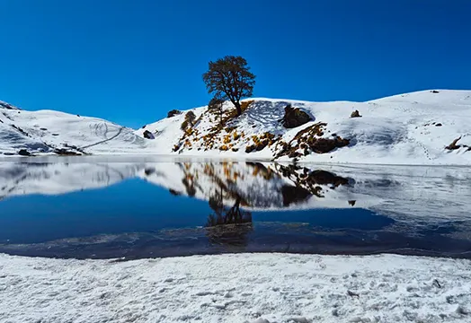
Winter is almost here, and you're still planning on following the same routine. Sitting in a blanket, sipping on hot tea, and binge-watching your favorite movies.
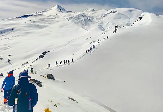
Every season in the Himalayas has its own way of showing off the mountains, but winter reveals a different side of them, one that feels like a whole new world.
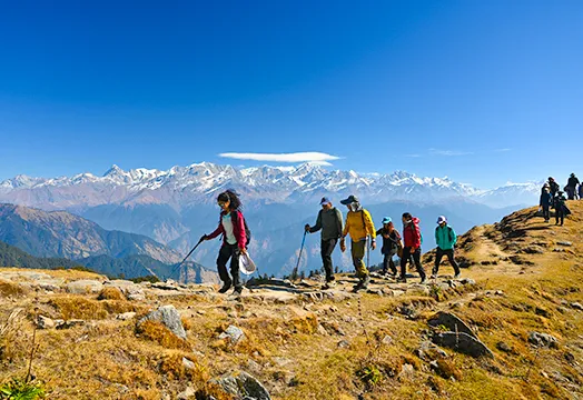
As monsoon season comes to an end, it washes away all the dust and haze that remains in the valleys throughout the summer, and then?
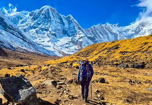
Located in north-central Nepal's Gandaki Province, Annapurna is the world's 10th highest and one of the most challenging mountains on the planet. Its height rises to 26,545 feet. Yet reaching Annapurna base camp is a far more accessible adventure, drawing trekkers from around the world every single season.
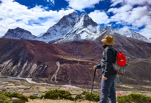
What does it feel like to stand on a trail where the mountain before you is worshipped as a goddess? For most of us, it's an adventure. But for the local communities who live in its shadow, it's something closer to faith. That mountain is Everest.

Over the last few decades, trekking has driven a profound shift: rural economies and local communities are reaping direct and indirect benefits.

Hiking teaches you to fall in love with the outdoors. Trekking teaches you to endure it. Mountaineering teaches you to respect it completely.

There are only a handful of Himalayan regions that hold profound spiritual significance as well as immense natural beauty. The Gaumukh Tapovan trek is one such destination that wonderfully combines adventure, divinity, and extraordinary Himalayan beauty.

What if a trek could leave you with more questions than answers? What if, after days of trekking, you reach a lake filled with centuries-old human skeletons?

Every year, every season reveals a new side of the Himalayan range. Be it trails covered in colourful rhododendrons or trails transformed into a lush green paradise, each season offers some of the most mesmerizing views of the Himalayas.