Pin Bhaba Pass Trek

Region
Himachal Pradesh | India

Duration
8 Days

Max Altitude
16100 Ft.

Trekking Km
51 KM

Grade
Moderate to Difficult
Get in Touch with Our Trek Expert
91 7302321133 info@trekthehimalayas.comMonday - Saturday: 10 AM to 09.30 PM (GMT +5:30)
Sunday: 10 AM to 05.30 PM (GMT +5:30)
17900 /Person
- July-2026
- August-2026
- September-2026
- 5% GST will be applicable on Trek Cost and Add-ons
- Services from Kafnu to Kaza.
- Meeting Point( Pickup point ): Old Bus Stand, Shimla.
- Reporting Time: 5:30 am
- Drop Point: Manali Bus Station.
- Drop Time: 6:30 pm to 7:30 pm (Timings are subject to change based on weather and road conditions).
- Please reach Shimla a day before to avoid any delays.
Add-ons
Insurance 320
- Insurance is mandatory.
- It is available for Indian citizens only.
- Non-Indians have to take insurance on their own.
- If you already have the high altitude trekking insurance, email for a refund after booking.
- The cancellation policy will be implemented in accordance with the trek cancellation policy.
- For more details about insuranceclick here
- + 5% GST will be applicable
Transport 3500
- Transportation from Shimla to Kafnu & return is optional.
- Choose add-ons during booking. If missed, log in and add them later.
- Book transportation at least 10 days before the trek.
- Cancellation 4 or more days before the start of the trip results in a 100% cash refund.
- Cancellation less than 4 days from the start of the trip results in a 50% cash refund.
- Cancellations made on the trip date are not eligible for a refund.
- + 5% GST will be applicable
Offload 4000
- Backpack offload is optional.
- Choose add-ons during booking. If missed, log in and add them later.
- Book off-load at least 10 days before the trek.
- For offline bookings at the base camp, a convenience fee of Rs. 4500 applies.
- Cancellations made before the trip date will receive a full refund.
- + 5% GST will be applicable
Get in Touch with Our Trek Expert
91 7302321133info@trekthehimalayas.com
Monday - Saturday: 10 AM to 06 PM (GMT +5:30)
Overview
Trek Name: Pin Bhaba Pass Trek
Days: 8
Adventure Type: Trekking
Base Camp: Kafnu
Season:Monsoon |
Month:July | August |
Country: India
Altitude: 16100 Ft.
Grade: Moderate to Difficult
Rail Head: Kalka
Stay: Camping (Twin sharing) & Hotel/Guesthouse ( triple/quad sharing, Separate for male & Female)
Food: Meals while on trek & at Kafnu guesthouse (Veg & Eggs)
Location: Himachal Pradesh
Distance: 51 Km.
Trail Type: Cross over trail | Start in one valley, traverse the pass, and ends in another valley.
AirPort: Jubbarhatti Airport, which is 22 km away from Shimla
Highlights:
- 5% GST will be applicable on Trek Cost and Add-ons
- Services from Kafnu to Kaza.
- Meeting Point( Pickup point ): Old Bus Stand, Shimla.
- Reporting Time: 5:30 am
- Drop Point: Manali Bus Station.
- Drop Time: 6:30 pm to 7:30 pm (Timings are subject to change based on weather and road conditions).
- Please reach Shimla a day before to avoid any delays.
Why is Pin Bhaba a Must-Do Trek ?
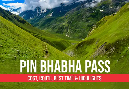
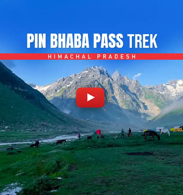
- Experience the stunning contrast of landscapes, from the lush green Bhaba Valley to the cold desert beauty of Pin Valley. It feels like stepping into two completely different worlds within a single trek.
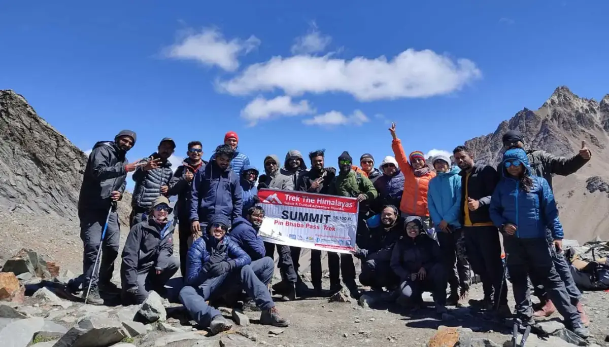
- Being over 16,000 feet, crossing the Pin Bhaba Pass is both a physical challenge and a visual reward. The panoramic view from the top is something you’ll always remember.
- Every campsite is amid the most beautiful frames of Himachal, nestled by rivers and surrounded by dramatic mountain scenery, with vast green fields around.
- From the apple-laden village of Kafnu to the charming Mudh village in Spiti, the trek lets you witness Himachali village life up close.
- For the initial days you trek through forests and meadows, dotted with beautiful wildflowers, that feels no less than a floral paradise.
- As you enter Pin Valley, the mountains take on soft shades of pink, purple, and brown, a surreal, painted landscape.
- Every hour brings a completely new visual story, perfect for photographers who want variety- rivers, valleys, deserts, and unique light patterns due to changing weather.
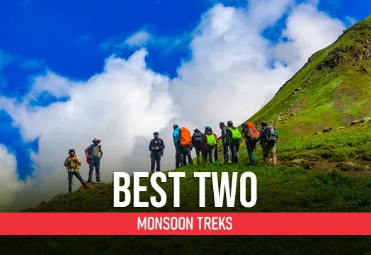
- The trek remains less crowded, and lets you witness the exquisite monsoon beauty of the Himalayas.
Who Can Participate
- Age Requirement:
- Minimum 14 years
- First-timers are welcome, though prior trekking experience is preferred. Good fitness is a must.
- Fitness Criteria:
- If the trekker wants to carry a backpack then he/she should be able to carry a 10-12 kg backpack. If opt Off-load option then the trekker should be able to carry 3-5 kg backpack.
- If a trekker's BMI is more or less than the normal range (18-27), please consult our Trek Coordinator before booking.
Pin Bhaba Pass Trek Itinerary
Shimla to Kafnu
- Altitude: Kafnu - 2,450 m/ 8,000 ft.
- Drive Distance: 200 km | 7-8 hrs.
- Pick up: Old Shimla Bus Stand at 6:30 am.
- Breakfast and lunch excluded, dinner included.
- Attraction: Hydroelectric power project on the Bhaba River.
- Keep a fleece jacket handy while traveling to Kafnu.
- Stay in guesthouse.
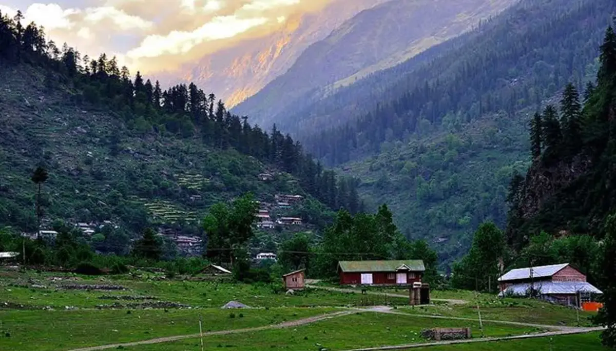
Once you arrive at Shimla, get ready to start a long journey to Kafnu. The day will begin early and our representatives will pick you up from Old Shimla Bus Stand. Kafnu is a serene village, remotely situated, almost 200km away from Shimla in the southern parts of Himachal Pradesh. Although there isn’t anything else on our schedule today since it is a long drive to Kafnu, starting as early as possible is always better. The ride will be 7 hours long but the road comes with beauty and joyride of turns and twists. Kafnu is a known village of Kinnaur due to the Hydroelectric project. Kafnu is a year-round vacation spot near Shimla and as such, there is good connectivity through buses from Rampur.
On the way, you can sight India’s first underground Hydroelectric project. A stunning blue lake is formed near the dam. En route, you will catch scenic mountain views with colourful roofs appearing and disappearing, as you cross tiny mountain settlements. The Sutlej River runs in the rocky background of the mountains. The moment you get closer to the village you can find views of Bhabha valley. After you cross the Wangtoo Bridge, you can see the Kinnaur Ranges appearing in clear view. Once you reach Kafnu, you can see the slopes of the village covered in apple orchards and the beautiful Sutlej River circling in and out of the village. Kafnu is a great place to start your Pin Bhaba Pass Trek. At the end of the drive, a warm stay will be waiting for you. Rest in your hotel for the night, because a beautiful trek is awaiting you.
Kafnu to Mulling
- Altitude: Mulling - 3,200 m/ 10,700 ft.
- Altitude difference: 850 m/ 2,700 ft.
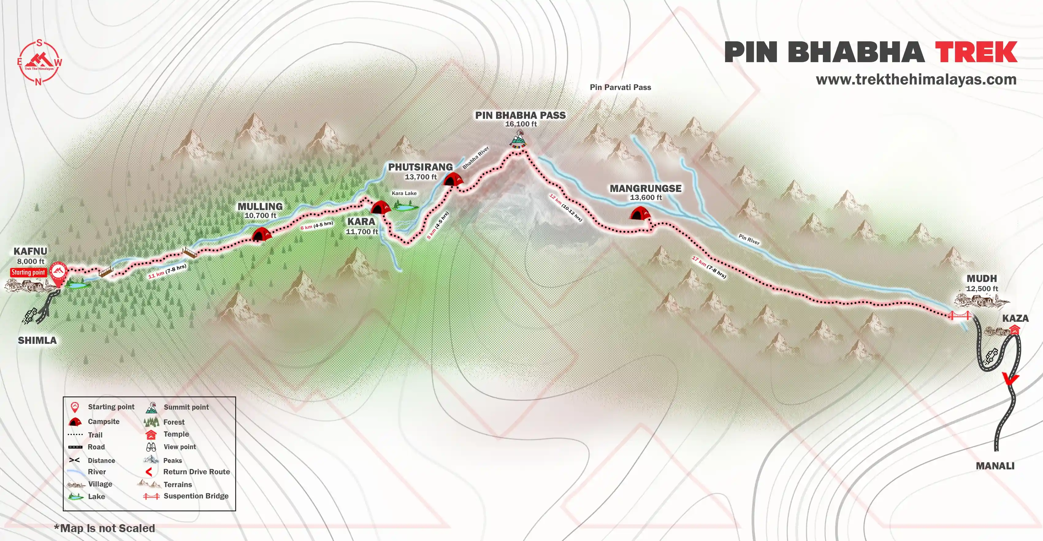
- Trek Distance: 11 km | 7 - 8 hrs.
- Moderate To difficult level walk.
- The first half is gradual and the second half is a difficult ascent.
- Spot Bhabha Hydro Project, India’s first underground dam.
- Trek in the forest (Silver birch, Pine, and Oak Tree).
- Natural water sources available on the way.
- Packed lunch for the day (bring one lunch box with you).
- Stay in tents (twin sharing).
The first day of the trek begins from Kafnu. You can consider this day as a wholesome day with 8-9 hours of a hike up through the trail of ascension. It will get you all pumped up for the surprises following next. The trek will bring rarely-seen sights of dense Pine forests and gushing rivers. The challenge of today's trek is the length of the walk and also the gain in altitude. Within a span of 11 km, you will also gain an altitude of 850 m. This means it’s going to be a steady incline with some plain patches here and there.
Immediately, when you start at 200 meters you can see India’s first underground Hydel project dam. Although photography is not allowed, make sure you capture the sight in your mind. To start with the hike is a walk of almost two and a half kilometers on a service road. Enjoy the lively surroundings and be prepared for 2800 feet of height gain. Initially, you will walk on a motorable road in the vicinity of the Janglik Range with the Bhaba River flowing close by you. This motorable route will lead to a small path where the actual trekking path starts. Before this, you will cross a bridge on the Bhabha River. This bridge will take you to the left bank of the River.
You will be trudging slowly between silver birch, oak, and pine trees. It is a dense forest harboring birds that keep you enthusiastic with their chirpy sound. You will walk under this salient flora for 5.5 km. The tall alpine trees will make the hike soothing for the eyes and unique. You can see the valley gets narrow and you will be on the left bank of the Bhabha river. Some further walks will take you to a clearing, where the terrain is strewn with mud, small stones, and grass.
The next big spot that comes after 1.4 km is the alluring camp of Champoria. The campsite is wonderful with trees around it. Cross another bridge ahead of the campsite. After crossing the walk on the right bank of the Bhabha River. The ascending trail will then start. The trail is 2 km take your steps slowly until you reach Jhandi Top(10,640 feet). You can rest on the Jhandi Top while soaking in the beauty surrounding you. You can also see your destinations Mulling from here.
After you are ready to start walking. It is only a matter of 1.5 km before you finally arrive at Mulling campsite. The campsite is extremely pleasant and the long tiredness will just vanish away. Colourful flowers decorate the campsite as the turquoise river gushes by. You can have your hot tea gazing at the beautiful sunset alongside the river on green meadows. After having an early dinner, retire to your tents. It is important to get proper rest after dinner as it is your first night in a camp at a high altitude. Rest well and give your body time to adapt to the high-altitude condition so that you can wake up fresh for your trek the next day.
Mulling to Kara
- Altitude(Kara)- 3,550 m/ 11,700 ft.
- Trek Distance: 6 km | 4 - 5 hrs.
- Altitude difference: 300 m/ 1,000 ft.
- Easy walk on rocky terrain, the last 1 km is a steep ascent.
- Camp near the Lake.
- Hot lunch campsite.
- Stay in a tent.
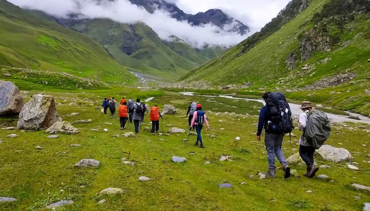
Today will be a little shorter day compared to yesterday but will be filled with bigger surprises. The start will be with a gradual ascent and rocky route. Today, you will have to cross some tricky sections, which are actually hidden boulders. Make your way through rocks for 1.5 km until you arrive at an amazing waterfall. Initially, you will also see a patch of the forested area where it gets darker and chillier and you have to cross the stream to get to the other side of the huge meadows forming a different yet picturesque landscape. Today you are going to face two major challenges one is crossing the gushing river by getting your feet in the icy cold water and the second is a steep ascent of 300 m which can be pretty tiring, especially with the weight on your back. The trail that takes you to the next campsite is clearly defined.
The ascent continues for another 1.7 km. You will be stunned as you arrive at this point because you will hear the sounds of the gushing river but see nothing. This is a natural phenomenon called the subterranean river, where the river flows underground. Take the most of this exceptional phenomenon. Now there will be a steep ascent for another 1.5 km.
There is a small stone bridge to cross a stream. After the steep ascent, you will be welcomed by another serene meadow. The grasslands have blossomed with vibrant flowers. Feel lucky to walk between these flowers for a kilometer, unless you reach your campsite. From the meadows, you will zig-zag across the mountain through a gradual uphill climb. The last bit of the hike involves you dipping your feet in the water once more to reach across to the warm respite of your campsite.
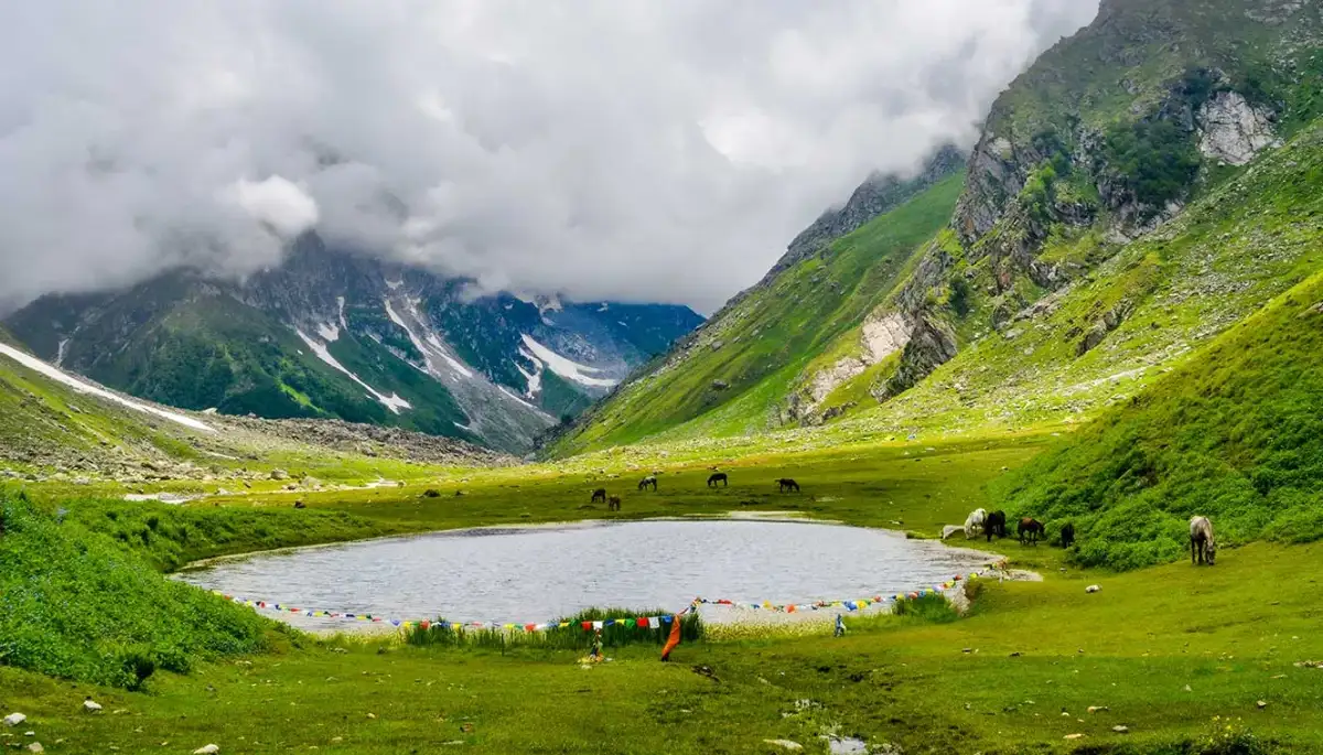
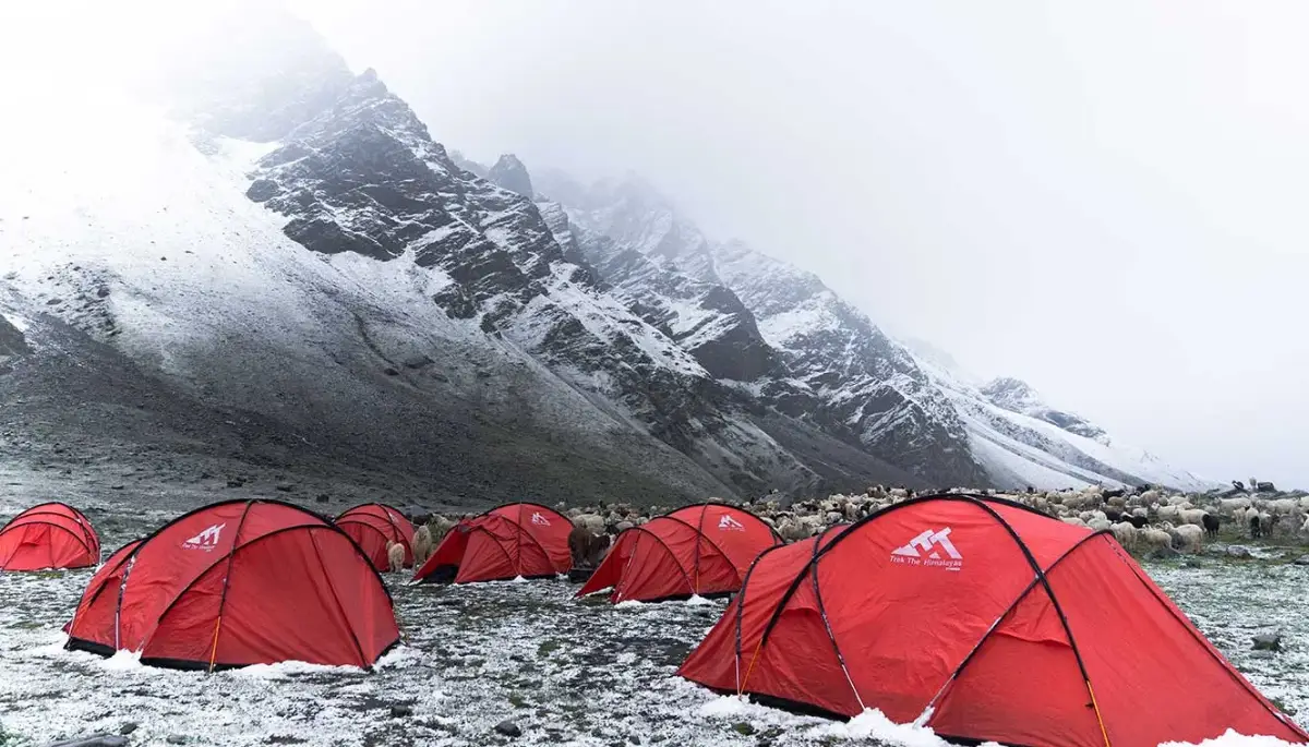
The campsite is somewhat similar to the last days. However, there is a lake that boasts a reflection of the surroundings. You can find many Shepherds with their cattle on Kara grassland. After reaching your campsite, have a delicious hot meal. On open meadows, beside the lake and grazing animals, sleep well in your tents.
Rest and Acclimatization at Kara
Today is an important day in your trekking journey, a rest and acclimatization day. At high altitudes, oxygen levels drop, and your body needs time to adjust to this change. Acclimatization helps prevent altitude-related issues and ensures you stay fit and comfortable as you move higher. Giving your body this time to adapt is key to a safe and successful trek.
Kara is one of the most scenic campsites on the route. With a beautiful view of mighty peaks, the site also features the serene Kara Lake nearby, a magical spot where the mountains reflect perfectly in the calm, clear water. It’s a peaceful and picturesque place that feels like a dream.
Though it’s a rest day, it’s good to stay gently active. You can take short walks around the area, soak in the natural beauty, chat with fellow trekkers, or simply sit back and enjoy the views. Don’t forget to click some stunning pictures, this is one of the most scenic campsites of the entire trek.
Kara to Phutsirang
- Altitude (Phutsirang)- 4,200 m/ 13,700 ft.
- Trek Distance: 5 km | 4-5 hrs.
- Altitude Difference: 600 m/ 2,000 ft.
- Moderate walks, continuous ascent.
- Enough water sources available on the way.
- The terrain is a combination of stone and loose mud.
- The first attraction is crossing the mountain stream.
- Last day with Bhaba River.
- Views: Hansbeshan Peak, Nimish Khango, Tari Khango, and Pin Bhaba Pass.
- Hot lunch at campsite.
- Stay in a tent.
This is the shortest day of the trek but the incline is much steeper compared to the day before. It is like a bonus day with a change in terrain and scenery. Today, we will also have multiple river crossings. Begin with the Bhabha river crossing followed by a steep ascent. Roll your pants up and step into the river, you will need to work as a team to get to the other side of the river. You will cross a collection of six streams to get to the other side. Fill the river with your eyes, as henceforth the river disappears flawlessly.
The Phutsirang Nala will be on the right as you walk on its left bank. The trail is a mix of boulders and stream crossing. Make sure you use your trekking poles efficiently and watch your step. You will require much more caution and balance on today’s trek. There are some sections, where the rocks are prone to slipping so you need to move continuously on these sections. For 4.5 km, there will be a steep ascent followed by a gradual path leading to open land.
There are two campsites, the lower and upper ones. But we climbed a little up for 200 meters towards the upper Phutsirang campsite. If there is too much snow, we will camp at the lower Pushtirang campsite, otherwise, we will climb up to the upper Phutsirang campsite. You will be delighted to take those last few steps up. The views from here are stupendous, more than you expected. You can see Hansbeshan Peak, Nimish Khango, Tari Khango, and Pin Bhaba Pass. Tuck in soon into your tents to get an adequate amount of rest and help your body recuperate after all the climbs.
Phutsirang To Bwaldar via Bhaba Pass
- Altitude: Bwaldar - 4,150 m/ 13,600 ft | Pin Bhaba Pass - 4,900 m/ 16,100 ft.
- Trek distance: 12 km | 10-12 hours.
- Altitude difference: 800 m/ 2,500 ft.
- The day is difficult and tiring.
- Continuous steep ascent till pass, after passing steep descent for 3 km and then gradual descent till campsite.
- Limited water sources.
- Start early at 2-3 am.
- Pin River can be seen from the pass.
- The scenery will change, from lush green to cold dessert.
- Keep floaters, and flip-flops handy to cross the river.
- Packed lunch for the day.
- Stay in a tent.
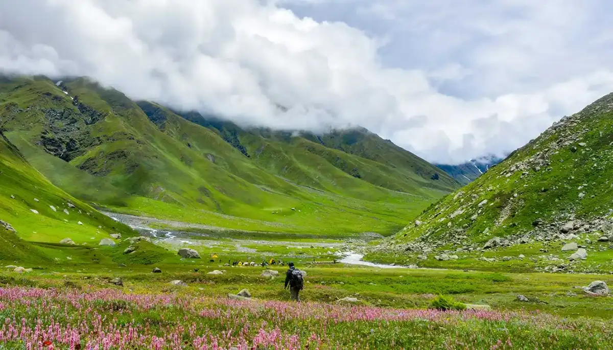
Finally, wake up with a lot of enthusiasm and energy. The most awaited day of treading to the pass is a few hours away. You will begin early in the morning around 2 AM. Today you will have to conquer steep slopes to reach the pass connecting the Pin and Bhaba Valleys. During the journey you will notice a drastic change in the views from vegetation to the cold desert of Spiti.
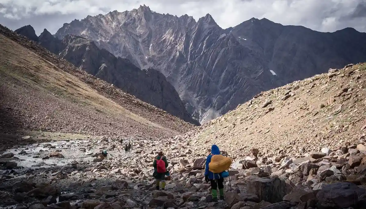
There will be a continuous steep ascent until the pass. Begin by walking on the loose scree. There will be a cold stream crossing followed by a steep climb. Walk up the steep hill until you reach the pass. You can see that the pass is the lowest point between the mountains. The pass is a confluence of Pin and Bhabha Valley, hence the name. From the top of the pass, you can see two distinct landscapes on two different sides. The geographical contradiction is the most in this part and as you keep crossing the pass, the landscape becomes rugged with the mountain turning brown and cold desserts beginning to show up.
If you look back towards the Bhabha side you can see the greenery from which you rose. And if you look at the Pin Valley side, you can find dry, beige mountains. You will soon enter the Spiti. The descent is steep and risky. Be careful and take your time to climb down. The descent is continuous for a long while until the slope gets gradual. Again there will be a river and stream crossing. You will arrive at the Bwaldar campsite after a long trek. Spend your night in the majestic sights, while you can also enjoy the amazing night view of abundance of stars.
Bwaldar to Mudh and Drive to Kaza
The last day of the trek is here. It is the last chance to breathe in the astonishing mountains. Gather all the energy. We will start as early as possible. It is a gradual ascent with loose rocks and scree. Cross a river stream on a wooden bridge to enter on a flat path. From Bara Boulder, you will follow a gradual descent along a rock-filled, moraine section. The region here is dominated by red soil and small-sized red stones.
Enjoy the amazing trail henceforth which is laid with red soil. You will also cross Pharka village. There will be sheep flocks welcoming you. Walk for a while on this path to cross another bridge. Ahead of this bridge is the scenic Mudh village, a fantastic form of nature’s beauty.
The last section comes ahead. You will cross the Pin River over a suspension bridge. Then comes a small hike up to the Mudh village. It is the last village in Spiti in that region, about 50 km from Kaza. The village houses very few people and they surely are the friendliest and fittest lot. From Mudh, you will then get into your vehicle which will take you to Kaza. Kaza is the largest township in that region of Spiti and is also considered the commercial hub of Spiti Valley. You will find many shopping opportunities in Kaza as well as you can pay a visit to the monasteries. You will stay in Kaza for the night.
Kaza To Manali
- Drive Distance: 200 km | 9 -10 hrs.
- Leave early in the morning.
- Breakfast and lunch on the way (not included in the cost).
- You’ll reach Manali between 6:00 pm and 7:00 pm.
And the final day of the trek that takes you back to Manal. The journey will be long of 9-11 hours long. But the views will be astounding. You will cross the famous Rohtang Pass to reach Manali. TTH provides transportation for drop-off at Manali. You can expect to reach Manali by 7:00 pm, post which you can make your further bookings.
Day-1: Shimla to Kafnu
- Altitude: Kafnu - 2,450 m/ 8,000 ft.
- Drive Distance: 200 km | 7-8 hrs.
Day-2: Kafnu to Mulling
- Altitude: Mulling - 3,200 m/ 10,700 ft.
- Trek Distance: 11 km | 7 - 8 hrs.
Day-3: Mulling to Kara
- Altitude(Kara)- 3,550 m/ 11,700 ft.
- Trek Distance: 6 km | 4 - 5 hrs.
Day-4: Rest and Acclimatization at Kara
Day-5: Kara to Phutsirang
- Altitude(Phutsirang)- 4,200 m/ 13,700 ft.
- Trek Distance: 5 km | 4-5 hrs.
Day-6: Phutsirang To Bwaldar via Bhaba Pass
- Altitude: Bwaldar - 4,150 m/ 13,600 ft | Pin Bhaba Pass - 4,900 m/ 16,100 ft.
- Trek distance: 12 km | 10-12 hours.
Day-7: Bwaldar to Mudh and Drive to Kaza
- Altitude: Mudh - 3,800 m/ 12,500 ft.
- Trek Distance: 17 km | 7 - 8 hrs.
Day-8: Kaza To Manali
- Drive Distance: 200 km | 9 -10 hrs.
- Leave early in the morning.
- Breakfast and lunch on the way (not included in the cost).
- You’ll reach Manali between 6:00 pm and 7:00 pm.
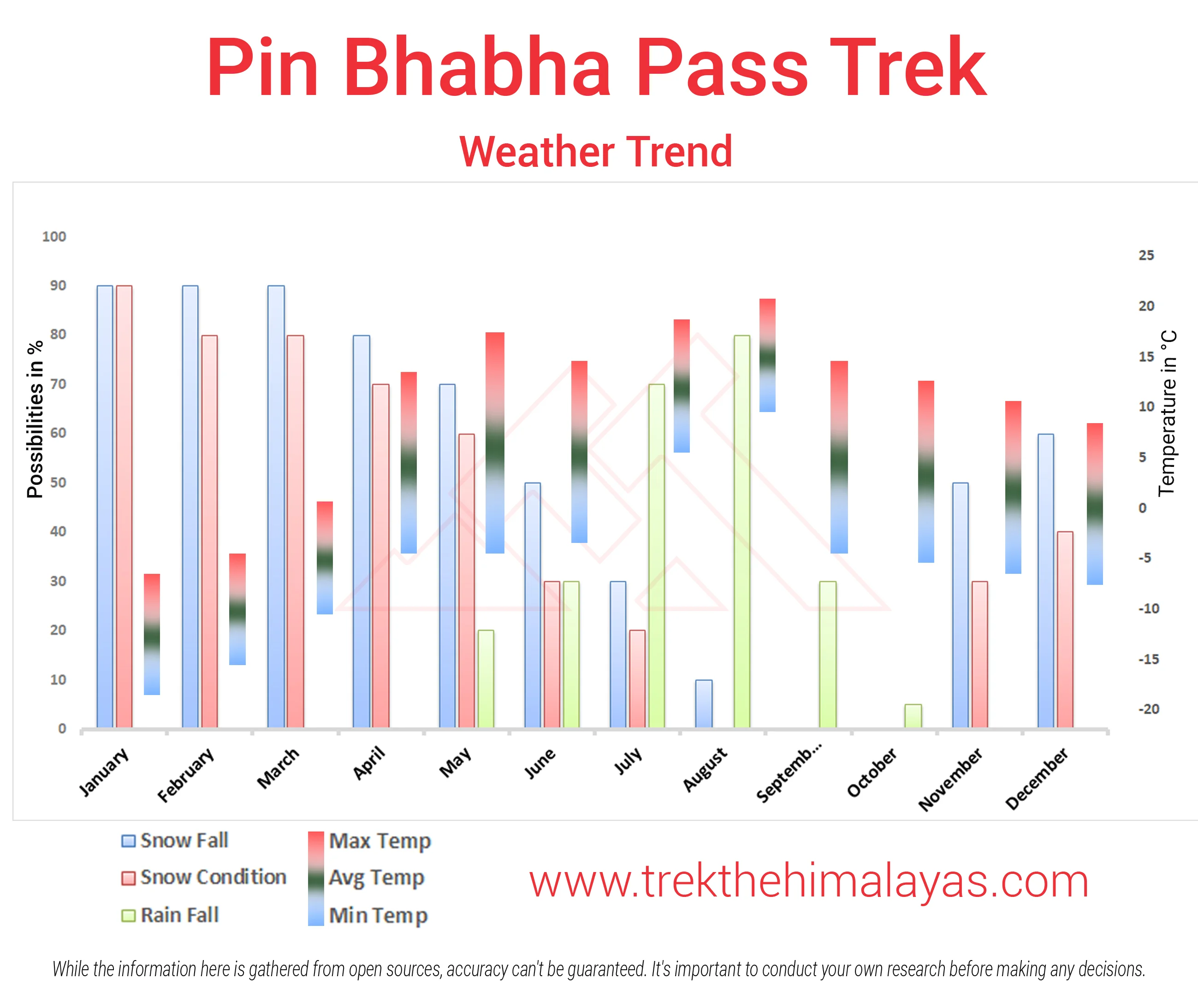
Pin Bhaba Pass Trek Graph

- Pulse rate at rest must be in between (60 to 100 beats per minute).
- Blood Pressure Reading must be in between (DIASTOLIC 75 – 85, SYSTOLIC 100 - 130 mm Hg).
- Respiratory rate at rest must be in between (12 to 20 breaths per minute).
- Should not have Liver and kidney issues.
- Should not have Diabetes Mellitus, Bronchial Asthma, Heart problems, Hypertension, etc.
- No pacemaker implant.
- People with Sinus issues, Epilepsy please contact to trek coordinator before booking the trek.
- If your BMI is not normal, Please contact our Trek coordinator before Trek booking.
Medical & Disclaimer Form (Mandatory Documents) Click here to download Medical & Disclaimer Form
Government employees can avail the benefit of Special Casual Leave (SCL) when they join us for a trekking expedition. As per Pay Commission guidelines, up to 30 days of Special Casual Leave can be availed in a calendar year for trekking or mountaineering expeditions conducted through a registered organisation.
Trek The Himalayas is a registered adventure tour operator with the Indian Mountaineering Foundation (IMF) and the Ministry of Tourism (MoT), making your trek eligible for SCL benefits.
To apply, email us at info@trekthehimalayas at least 20 days before the trek departure date, with the following details:
- Trek name and trek date
- Booking details
- Full name
- Designation
- Department and department address
This benefit is exclusive to Indian Government employees and is applicable only for treks within India.
- Junior trekkers (below 15 years) should have a company of parents/guardians.
- Trekkers between 15 to 18 years can come solo with the disclaimer form signed by parent/guardian.
- Medical & Disclaimer Form (Mandatory Documents) Click here to download Medical & Disclaimer Form
Since the inception of Trek The Himalayas, countless trekkers have chosen us to be a part of their trekking journey. Some experiences were learning moments, while many of you returned time and again, allowing us to be part of your most unforgettable adventures. Over the years, we have continuously evolved, improving our operations, and every detail that shapes your experience.
Through it all, you have shown us that we are not just another trekking company to you, we are family. Your trust, loyalty, and love mean more to us than words can express, and we cherish every step we have taken together in the mountains.
As a small way of giving back and saying thank you for choosing us again and again, we are excited to introduce something special: our heartfelt expression of gratitude to our valued and loyal trekkers.
We are launching two amazing policies to make your trekking journey even more exciting.
YES! Not one, but TWO unbelievable policies
Policy 1 : TTH Trek Ambassador Policy
In the TTH Trek Ambassador Policy, anyone who has completed four treks with us gets the fifth trek absolutely free. You can choose from a variety of treks that we offer in himalayan states of India including Ladakh, Uttarakhand, Himachal Pradesh, Sikkim and West Bengal. You just need to start creating your trek bucket list and we are here to help you accomplish it.
Thinking, “I have already done more than 6 treks with TTH, what about me?” In this case you automatically qualify for the policy and therefore, your next trek will be on us. In fact, for every 8 treks you complete, 2 treks are on us.
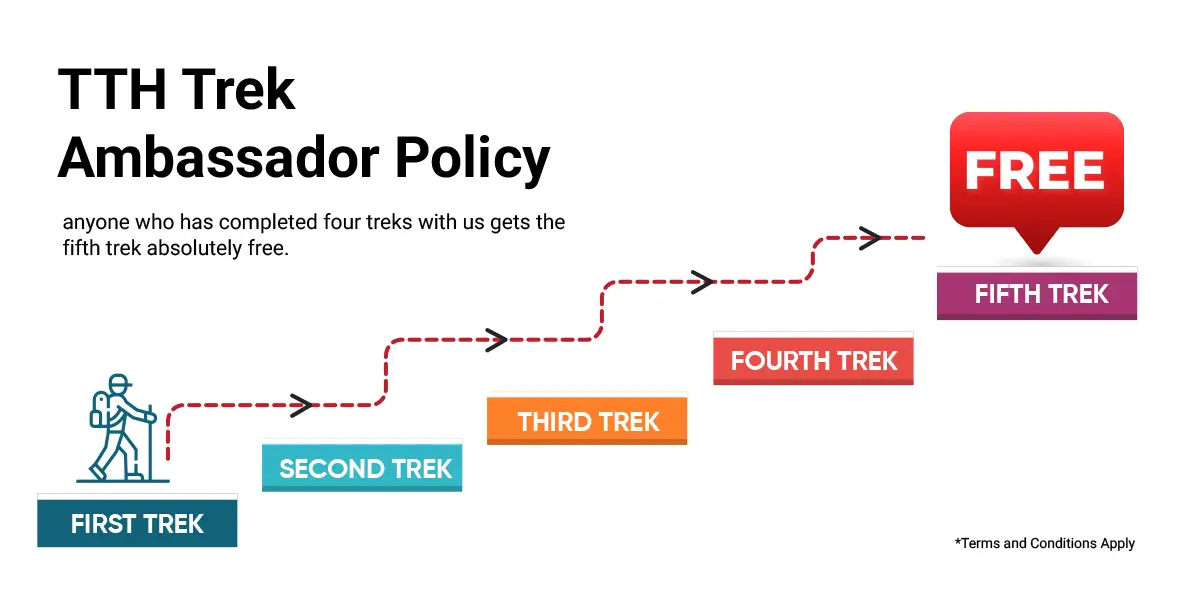
As Unbelievable as it Sounds, Your 5th Trek is Sponsored by Us - Choose any Trek You Love
Love the Chadar Trek? It could be free!
Your dream treks including Markha Valley, Bali Pass, Pin Bhaba Pass, or Lasermo La Trek (launching soon) can be yours at no cost under this policy.
Just like five stars make a perfect set, you are that fifth star for TTH. But this star does more than shine; it guides and inspires. You will share your tips, your stories, your experiences, and help new trekkers enjoy the journey as much as you do. That’s why this trek is special, and it’s your chance to be a TTH Trek Ambassador on the trail.
Being an avid trekker comes with excellent trekking knowledge and experience, and we would love you to share that and guide fellow trekkers along the way.
You will be introduced as our TTH Trek Ambassador to your fellow trekkers. Your experiences will glorify the shine of treks! And we can't wait, just to see how you make the journey just as beautiful as the Himalayan trails themselves!
What About Those Who are Just Getting Started?
Those who are just starting their trekking journey are also eligible for this policy, they just need to complete any four treks/expeditions with us (weekend treks, panch kedar excursion, and multi-sport adventures count too) and they will get the chance to become a TTH Trek Ambassador with their fifth trek absolutely free of cost.
Policy 2: Loyal Customer Policy
After you become a TTH Trek Ambassador with Trek The Himalayas, you will unlock our Loyal Customer Policy, a perk that keeps giving every time you share the joy of trekking.
Once you complete all four treks with TTH, you receive a unique referral code that you can share with your friends and family.
When someone books a trek using your code, you will receive trek points based on the difficulty level of the trek and the referred trekker will receive the same amount of discount while booking the trek. Here is the breakdown of the trek points and discount you and your friend will get.
- If the referred trek is an Easy trek, both of you will receive ₹500 as trek points and discount.
- For a Moderate or Moderate to Difficult trek, both will receive ₹700 as trek points and discount.
- For a Difficult trek, both will receive ₹1,000 as trek points and discount.
- For a Challenging trek, both will receive ₹1,500 as trek points and discount.
Kindly Note: 1 Trek Point = 1 Rupee
These trek points get added to your loyalty points balance and you can redeem these points while booking for your next trek. The more you refer, the more your balance grows.
For example:
If you collect 15,000 as your trek points, you can use them to book any trek within that value. As your balance grows, the possibilities expand and you could use your points for treks and expeditions of higher value anywhere in India, and abroad. Your loyalty points open the door to all kinds of trekking experiences in India and Internationally.
Another great part of this policy is its flexibility. You won’t believe it, but you can also transfer these loyalty points to anyone you like if you’re unable to use them yourself. You can either share or split them with friends or family.
You can also track your loyalty points balance anytime in your TTH dashboard, and we will also keep you updated through notifications whenever the trek points are added or redeemed.
TTH Trek Ambassador Policy FAQs
- What is this initiative all about?
- What if my upcoming trek is my fifth trek with Trek The Himalayas ?
- Can Chadar Trek be included as a free trek under this policy?
- Are weekend treks included in the count?
- I’ve already completed eight treks with TTH. Does this mean my ninth trek is also included?
- Why should I choose TTH over other organizations?
- If my child has completed four treks with TTH, can their Summer Camp be chosen as the fifth free trek?
- Which treks are eligible as free treks under the TTH Trek Ambassador Policy?
- Can I choose a Challenging grade as my free trek?
- How do I claim this benefit for my fifth trek?
- Do I need to make a payment while booking the fifth trek?
- If the trek is offered by TTH, why do I need to pay the amount upfront?
- Why does TTH follow a pay-and-return process?
- I already have multiple upcoming treks booked. Which one will be counted as my fifth trek?
- What if my four treks were registered using different email IDs?
- Can I choose international treks like Everest Base Camp or Kilimanjaro as my free fifth trek?
- Do repeat treks count toward my free fifth trek?
- Does the free trek cover things like insurance, transport, or extra charges?
- I’ve done some treks with other organizations. Do they count?
This initiative is our way of appreciating trekkers who continue to walk with TTH again and again. When you complete four treks with us, you reach an important milestone in your trekking journey. Your fifth trek is then offered by TTH as a gesture of appreciation. You will step in as a TTH Trek Ambassador, sharing your stories and inspiring others with your experience. Along with this, you also unlock Loyal Customer policy in which you can earn the trek points by sharing the referral code with your friends and family.
If your upcoming trek is your fifth trek with TTH, the trek fee for that trek will be completely waived. To ensure smooth planning, you need to register and make the full payment at the time of booking. Once you successfully complete the trek, TTH will refund the eligible trek fee within a week.
Please note that GST and trek insurance are fixed mandatory charges, so they will not be refunded. Any optional add-ons, like transport, gear rental, offloading, or special meals, are also outside the refund scope.
Yes, it absolutely can. And that’s what makes this policy special. If trekking in Ladakh has been your dream, this could be your moment. Iconic treks like Chadar Trek and Markha Valley Trek are available as options for your free fifth trek.
Of course! A trek is a trek, and all your TTH treks, including weekend or two-day treks count toward your free fifth trek.
Yes, and this is one of the nicest parts of the policy. The free trek benefit works in groups of four treks. After completing four treks, your fifth trek is free. If you have completed eight treks, the benefit comes again, and your ninth and tenth treks will also be free. In short,for every four treks completed with TTH, you earn free treks along the way. The more you trek, the more TTH gives back.
Trek The Himalayas offers a wide range of treks be it easy to moderate treks like Kedarkantha, Har Ki Doon, Ranthan Kharak or moderate to difficult treks like Bali Pass, Pin Bhabha Pass or Chadar. By the time you complete four treks in the Himalayas, you have already grown into an experienced trekker.
Naturally, you would now like to prefer to take a step up and choose a difficult trek as your fifth one. Here is where Trek The Himalayas stands out as it offers a variety of difficult treks. And luckily all of them are qualified as free treks under the TTH Trek Ambassador policy. With TTH, you get a variety of trek options to choose from. You can pick a tougher trail or go for an Easy or Moderate trek; the choice is yours.
Yes definitely, we’re happy to offer this. Young trekkers bring fresh energy and enthusiasm to the trail, which makes the journey even more special. If your child has completed four treks with TTH, they can choose a Summer Camp as their fifth free trek.
You’ll be happy to know that any himalayan trek from easy to difficult level can be chosen as your free trek. The best part is that treks like Chadar Trek, Markha Valley, and many other beautiful himalayan treks are included. You may also choose higher-grade treks such as Bali Pass or Pin Bhaba Pass as part of your free trek.
As a TTH Trek Ambassador, your role goes beyond just trekking. You become a mentor on the trail. Someone who guides and shares real experiences with fellow trekkers. After completing multiple treks with TTH, you bring valuable knowledge and perspective that naturally encourages others and adds energy to the group.
Your stories and practical tips help first-timers and intermediate trekkers feel more comfortable and motivated. This is where your experience shines and lifts the overall trekking spirit of the group.
Challenging and peak summit treks, however, follow a slightly different approach. These treks are designed for highly experienced trekkers and climbers, where every participant is already well-prepared and self-driven. In such settings, there is limited scope for peer mentorship, as the structure and demands of the trek are very specific.
That’s why challenging and peak summit treks are kept outside the free fifth trek option, not because they are out of reach, but because the Trek Ambassador role is best experienced on trails where your guidance, encouragement, and shared journey can add value to others.
To claim your free trek, please send an email to info@trekthehimalayas.com, and our team will take it forward from there.
Yes, you do. You need to pay the full amount at the time of booking, just like any regular trek. Once you successfully complete the trek, we process the return of the eligible trek fee within one week. This process helps us plan treks better and ensures that all participants are fully committed.
Each spot on a trek involves planning, logistics, and local arrangements. If someone cancels at the last moment, it directly affects the team and the opportunity for another trekker. Collecting the payment upfront helps us manage this responsibly. Once you complete the trek, the amount is returned as promised. If you cancel, the standard TTH cancellation policy applies.
To keep your trek planning smooth and fair, we collect the trek fee upfront. Last-minute cancellations can affect team arrangements and local logistics, so this pay-and-refund process keeps everything running smoothly while still giving you this special benefit fairly.
The trek that you actually complete as your fifth eligible trek will be considered under this initiative. Even if you have several treks booked in advance, the benefit applies to the trek that completes your fifth-trek milestone.
All four treks must be registered under a single email ID. This helps us confirm that the same person has completed all four treks with TTH. Please ensure your records are linked to one email ID.
The free fifth trek is only valid for treks within India. International treks, including those in Nepal or other countries, don’t qualify as your free trek. However, any international trek you’ve completed does count toward your total number of treks with TTH.
Each unique trek you complete adds to your total. If you repeat a trek you’ve already done, it won’t be counted toward your free fifth trek.
The free trek includes only the trek fee itself. Any extra costs like trek insurance, transport, gear rentals, offloading, or special meals are not included and will need to be paid separately.
To be eligible for the free fifth trek, we count only treks you’ve completed with TTH. But don’t worry, even if you’ve done weekend treks, pilgrimages, or international treks with us, they all contribute to your count. By the time you’re eligible, you’ve likely completed more than four treks with TTH anyway.
Loyal Customer Policy FAQs
- What is the Loyal Customer Policy?
- When do I become eligible for this policy?
- What is a referral code and how do I get it?
- Is there a limit to how many points I can earn?
- What is the minimum number of trek points I can redeem under this policy?
- Can I use these trek points for international treks?
- Can I transfer my trek points to someone else?
- Where can I check my trek points balance?
- Can I share my referral code with someone who has already trekked with TTH?
- What is the validity of the Loyalty points?
The Loyal Customer Policy is a special perk for TTH Trek Ambassadors. After completing four treks with Trek The Himalayas, you receive a referral code. When someone books a trek using your code, both you and the referred trekker earn trek points and discounts based on the difficulty level of the trek.
You become eligible for the Loyal Customer Policy after completing four treks with Trek The Himalayas and becoming a TTH Trek Ambassador. Make sure all your four treks must be unique.
A referral code is a unique code provided to you once you become a TTH Trek Ambassador. You can share this code with friends and family. When they use it while booking a trek, both of you receive trek points and discounts.
There is no limit to the number of trek points you can earn. The more you refer, the more points get added to your loyalty points balance, which you can redeem while booking your future treks.
There is no minimum limit for redeeming your trek points under this policy. You can start redeeming your rewards with as little as one trek point. Every trek point you earn holds value, giving you complete flexibility to use your points whenever and however you choose without waiting to accumulate a fixed number.
Yes! One of the best parts of the Loyal Customer Policy is that you can use your trek points to book any trek with TTH, including international treks.
This is the flexibility of the policy. You can easily transfer your points to friends and family, and they can use them for their own trek planning with TTH. Even if you want to split the points and use them with your friends, you can do that too and enjoy trekking together!
You can easily track your trek points anytime in your TTH dashboard. Also, we’ll keep you updated with notifications whenever points are added or redeemed, so you always know your balance.
No. Referrals must be for completely new members. Anyone who has already registered or trekked with TTH earlier will not be counted as a valid referral.
The Loyalty Customer accumulated points is valid for two years from the date it is issued.
Important Links
- Mandatory Documents to Bring on A Trek Click Here.
- How to pay Add-ons, Submit Medical Forms, and Dietary Preferences Click Here to watch Video
How To Reach
It is essential for everyone to arrive at Shimla (05:30 am)
Meeting
Place: Shimla Old Bus Stand.
Once you have reached Shimla, TTH will manage the rest of your travel arrangements, if you have opted for TTH's pick-up service, you can select this option during the booking process by adding it as an add-on (book it at least 10 days before trek date)
It is advisable to reach Shimla a day before to avoid any kind of delays.
Options to reach Shimla:
First, you can arrive at Chandigarh, Delhi, Kalka, or Shimla airport. The journey from these locations to Shimla is explained below.
1. Take overnight bus to Shimla from Delhi or Chandigarh, taking a bus from Chandigarh is the most ideal option.
-Chandigarh to Shimla Bus Stand : 120 km | 4 hr.
-Delhi to Shimla Bus Stand : 350 km | 10 hr.
( We always recommend going for the govt. Buses over the private ones outside the bus station as based on the experience we have found that there are very high chances of delay involved with private buses. Also, govt. Buses are always more reliable. Whichever bus you choose, just make sure to reach Shimla at least by 05:30 am. )
2. Take a Train to Kalka and drive to Shimla. One can take the pleasure of a toy train, If you're arriving by Train, then come one day in advance.
3. Take a flight to Shimla airport (Jubbarhatti airport) (22 km, 50 min). If you're arriving by air, then come one day in advance.
Drop-Off Information
- The designated drop-off point is the Manali Gov bus stand around 6:30 pm to 7:30 pm .
- Please consider planning your subsequent travel arrangements after 8:00 pm.
- It's highly advisable to keep a buffer day in your travel plan. If the buffer day is not needed, it can be used to explore Manali.
- TTH offers comfortable transportation through Tempo Traveler, Bolero, or equivalent vehicles. If you wish to upgrade your mode of transportation, please contact your trek coordinator for further assistance.
.webp)
Cost Terms
Inclusion
1. Insurance is mandatory.
2. Accommodation (as per the itinerary):
- Guesthouse in Kafnu on Day 1 (triple/quad sharing basis, males and females separate).
- Guesthouse in Kaza on Day 7 (triple/quad sharing basis, males and females separate).
- Camping during the trek from Day 2 to Day 6 (twin sharing basis).
3. Meals (Veg + Egg):
- Meals from Kafnu to Bwaldar.
- Day 1 dinner to Day 7 packed lunch.
4. Support:
- 1 versatile base camp manager: handles communication and deploys extra manpower in emergencies.
- 1 mountaineering and first aid qualified professional trek leader.
- 1 experienced high-altitude chef.
- Local experienced guides (number of guides depends on the group size).
- Adequate support staff.
5. Trek equipment:
- Sleeping bag, sleeping liners (if needed), mattresses, and utensils.
- 3-person all-season trekker tent (twin sharing), kitchen and dining tent, toilet tent.
- Camping stool, walkie-talkie.
- Ropes, helmet, ice axe, harness, gaiters, and crampons (if needed).
6. First aid:
- Medical kit, stretcher, oxygen cylinder, blood pressure monitor, oximeter, stethoscope.
7. Mules/porters to carry the main luggage.
8. All necessary permits and entry fees, up to the amount charged for Indians.
9. Services from Kafnu to Kaza.
10. Trek completion certificate.
Exclusion
- Insurance (For non-Indian Nationals, NRI or OCI card holders).
- Food during the transit.
- Any kind of personal expenses.
- Mule or porter to carry personal luggage.
- Emergency evacuation, hospitalization charge, etc.
- Any extra costs incurred due to extension/change of the itinerary due to natural calamities roadblocks, vehicle breakdown, etc. factors beyond our control
- Transportation (as per the itinerary):
- Shimla to Kafnu (day 1).
- Kaza to Manali (Day 8).
- Anything not specifically mentioned under the head Inclusion.
Things can be provided on demand and availability (participant has to pay extra for these things).
1- Satellite phone/set phone - a type of mobile phone that connects via radio links via satellites orbiting the Earth instead of terrestrial cell sites like cell phones. Therefore, they can operate in most geographic locations on the Earth's surface.
2- Gamow/PAC HAPO Bag (Portable Hyperbaric Bag) - is a unique, portable hyperbaric chamber for the treatment of acute mountain sickness (AMS), also known as altitude sickness.
3- AEDs (Automated External Defibrillators) - are portable life-saving devices designed to treat people experiencing sudden cardiac arrest, a medical condition in which the heart stops beating suddenly and unexpectedly.
Cancellation Terms
To request a cancellation, please email us at info@trekthehimalayas.com using your registered email ID.
Cancellations prior to 25 days from the start of the Trip
Refund Options
- 5% deduction of trek fee
- 100% trek fee cash voucher for any trip till one year
- Transfer your trek (any trek, any date) to your friend
Cancellation between 24 days and 15 days to the start of the Trip
Refund Options
- 30% deduction of trek fee
- 100% trek fee cash voucher for same trip till one year
- 85% trek fee cash voucher for any trip till one year
- Transfer your trek (same trek, any date) to your friend
Cancellation between 14 days and 10 days to the start of the Trip
Refund Options
- 50% deduction of trek fee
- 80% trek fee cash voucher for same trip till one year
- 70% trek fee cash voucher for any trip till one year
- Book the same trek, in the same season, with any other batch
- Transfer your trek (same trek, any date) to your friend
Cancellation less than 9 days to the start of the trek.
Refund Options
- No cash refund
- 20% trek fee cash voucher for the same trip till one year
- 10% trek fee cash voucher for any trip till one year
- Transfer your trek (same trek, same date) to your friend
- To reschedule a trek (same trek only), a 30 % rescheduling fee of the trek cost will apply.
Cancellation Policy (Emergency Cases):
In case of a death in the immediate family (parents, siblings, spouse, children) or if the trekker is hospitalized (min. 48 hours) or suffers a fracture (leg/arm) within a week before the trek, even if canceled a day before:
90% trek fee refund in cash & 10% as a voucher (valid for 1 year, for any India trek).
Valid documents required. We’re here to support you during tough times.
Note:
- Change of trek batch is dependent on the availability of seats in the batch
- In case of transferring a trek to a friend, he/she should satisfy all the mandatory requirements put forward by TTH
- TTH holds the right to change/cancel the policies, without prior notice
Booking and Payments
- The Participant is responsible for verifying the accuracy of all details, including Trip dates and personal documentation, at the time of booking.
- Payments must be made in accordance with the timelines and instructions provided by TTH. Late payments may result in cancellation of booking without refund.
- In the event of a cash refund, only the portion of the payment made in cash shall be eligible for refund in cash. Any booking made using voucher, discounts, promotional codes, or through any non-cash mode of payment shall not be eligible for a cash refund under any circumstances.
- Refunds, if applicable, shall be processed within 15–30 working days of confirmation.
- All add-on bookings are subject to the respective add-on cancellation policy, and refunds will be processed accordingly.
- Voucher Terms
- This is a non-transferable voucher
- The voucher cannot be merged with any other offer of Trek The Himalayas
- The voucher is valid for Trek booked directly with Trek The Himalayas in India
- To avail the voucher please use your register phone number or e-mail id
- All the other Terms of booking a trek with Trek The Himalayas are applicable to the voucher
Itinerary and Modifications
- TTH reserves the right to modify, shorten, or cancel any part of the Trip due to transportation delays, weather, health emergencies, or other unforeseen circumstances including Force Majeure.
Cancellations and Refunds
- No refunds or vouchers, partial or otherwise, shall be provided for voluntary withdrawal, non-utilisation of services, or removal from the Trip.
- If TTH cancels the Trip before arrival at the designated pick-up point due to unforeseen circumstances or Force Majeure, the Participant may choose from:
- An alternate Trip/date.
- A credit voucher valid for one (1) year.
- Transfer to another Trip, with cost differences payable by the Participant.
- If the Trip is abandoned post-arrival at the designated pick-up point, no cash refund or voucher shall be issued. The Trek Again Policy may apply at TTH’s discretion.
- TTH shall not be liable for any associated travel costs such as flights, accommodation, or visa fees.
Force Majeure
- Events beyond its control including but not limited to earthquakes, landslides, strikes, curfews, war, pandemic, government restrictions, heavy rainfall or snowfall, windstorms, road blockages, trail disruption, or withdrawal of permits, TTH shall not be held liable for any cancellation, delay, or service modification caused by Force Majeure.
Trek Essentials
Rent EquipmentPDF Of Trek Essential Download
| Backpack with rain cover | (50 - 60 ltr) with comfortable shoulder straps |
| Day pack with rain cover | 20 - 30 ltr (If off-load opted) |
| Walking stick | Advisable (At least one) |
| Water Bottle / Hydration pack | 2 bottles of one liter each, People who use hydration pack 1 hydration pack and 1 bottle of one liter. |
| Small size tiffin/lunch box | 1 Nos |
| Snacks | Energy bars, dry fruits, electral/ors |
| Personal Medical Kit | Consult your doctor |
| T-Shirt (Synthetic quick dry) | 2 Full & 2 Half sleeves |
| Fleece T-shirt | 1 Nos |
| Fleece jacket | 1 Nos |
| Windproof Jacket | 1 Nos |
| Down feather / Hollow jacket | 1 Nos |
| Thermal inner (Upper and Lower) | 1 Pair |
| Trek Pant (Synthetic quick dry) | 3 Nos |
| Fleece Pant | Not required |
| Waterproof gloves | Not required |
| Fleece / woollen gloves | 1 Pair |
| Poncho / waterproof Jacket and pant | 1 Nos |
| Sunscreen | 1 Nos |
| Moisturiser | 1 Nos |
| Chap-stick / Lip balm | 1 Nos |
| Toothbrush and toothpaste | 1 Nos |
| Toilet paper & Wipes | 1 Nos |
| Soap / hand sanitizers | 1 Nos |
| Antibacterial powder | 1 Nos |
| Quick dry towel | 1 Nos |
| Head torch | 1 Nos. (Avoid Hand torch) |
| Sun Cap | Not required |
| Woolen cap | 1 Nos. |
| Balaclava | Not required |
| Buff / Neck-gaiters | 2 Synthetic |
| Sunglasses | UV with dark side cover, People who wear spectacles - (A)- Use contact lenses | (B)- Photo chromatic glasses |
| Trekking shoes | 1 Pair (Water-resistant, high ankle, good grip) |
| Floaters / flip-flops | 1 Pair |
| Cotton socks | 7 pairs |
| Woollen socks | 1 pairs |
| Gaiters | 1 Pair (TTH provides when required) |
| Micro spikes | 1 Pair (TTH provides when required) |
Frequently Asked Questions(FAQ)
To register with TTH, visit our website - www.trekthehimalayas.com and create your account. To create your account you will need to use your email address and fill in all the details, set your unique password and your account is ready to use.
- To book a trek with TTH, you first need to register with us and create an account.
- Choose the trek that you want to do and click on available dates.
- You will land at the login page, fill in the required details.
- Add Participants, choose add-on services click on the Pay now button, choose your preferred payment method, and make the payment. TTH accepts multiple payment options, including credit/debit cards, net banking, and UPI.
- You will receive a confirmation email from TTH with all the necessary details about the trek, including the meeting point, transportation, accommodation, and other important instructions.
- Click Here to watch Video
please send an email to us at info@trekthehimalayas.com or reach out to the numbers provided in the Help and Support section of your Trek Page. We will ensure that your issue is promptly resolved.
To book services such as off-load luggage and transportation, you can find them listed as add-ons. These additional services can be booked at the time of your initial booking. If you miss booking add-ons during the initial reservation, you can log in anytime and easily book 4 days before the departure date add-ons through the platform.
If you have booked the wrong trek or selected the wrong date, don’t worry! You can contact us at +91 9368882322 (Monday to Saturday, 10 AM to 10 PM) or email us at info@trekthehimalayas.com. You can also discuss this with your trek coordinator. Please make sure to inform us at least 10 days before the departure of your trek. Only then can we help you reschedule or arrange another trek for you.
We recommend visiting our "Suggest Me a Trek" page. By filling out the form, our experts will contact you with the best possible trek options based on your preferences and experience level. Alternatively, you can reach out to us via email at info@trekthehimalayas.com or give us a call using the numbers provided on our website for personalized assistance and recommendations.
Family treks differ from regular treks by focusing on ease of difficulty, offering shorter durations for younger participants, Kid-friendly and easily digestible foods, child-friendly activities, maintaining a higher guide ratio for diverse age groups, and implementing additional safety measures for families.
Family Trek with Kids recommendation Only Dayara Bugyal and Chopta Chandrashila Trek.
Minimum age for TTH treks is typically 7 years, though this may vary depending on the specific trek.
Yes, you can take a kids to a high-altitude trek with a parent. Discuss with a trek expert before booking a trek.
- Junior trekkers (below 15 years) should have a company of parents/guardians.
- Trekkers between 15 to 18 years can come solo with the disclaimer form signed by parent/guardian.
- Medical & Disclaimer Form (Mandatory Documents) Click here to download medical and disclaimer form
Physical Fitness: Ensure your child is physically fit. Engage them in regular exercise, outdoor activities, and hikes to build stamina and endurance. Hydration: Emphasize the importance of staying hydrated at high altitudes. Encourage your child to drink water regularly, even if they don't feel thirsty. Proper Nutrition: Provide a well-balanced diet with sufficient carbohydrates for energy and foods rich in iron to prevent altitude sickness. Adequate Sleep: Ensure your child gets enough sleep in the days leading up to the trek. Quality rest is crucial for altitude adaptation. Educate on Altitude Sickness: Teach your child about the symptoms of altitude sickness, such as headache, nausea, and dizziness. Encourage them to communicate any discomfort immediately. Appropriate Clothing and Gear: Dress your child in layers to adjust to changing temperatures. Ensure they have appropriate trekking gear, including sturdy footwear. Positive Mindset: Foster a positive mindset. Encourage your child, and let them know it's okay to take breaks when needed. Medical Check-Up: Schedule a medical check-up before the trek to ensure your child is fit for high-altitude activities. Consult with a healthcare professional about any potential health concerns.
TTH takes special care to provide wholesome and nutritious food for children on treks. Here are some of the foods that are typically served for children:
Breakfast: For breakfast, TTH serves a variety of options like porridge, cornflakes, bread, butter, jam, honey, boiled eggs, omelettes, and pancakes. Children can choose from these options to fuel themselves for the day's trek.
Lunch: For lunch, TTH serves lunch which includes rotis, vegetables, rice, dal, and salad. The rotis are usually made fresh on the trek and are a good source of carbohydrates. The dal and vegetables provide protein and other essential nutrients.
Snacks: TTH provides healthy snacks like fresh fruits, dry fruits, energy bars, cookies, and biscuits to keep the children energized throughout the day.
Dinner: For dinner, TTH serves a hot and wholesome meal which includes soup, rice, dal, vegetables, and a non-vegetarian dish (if requested in advance). Children can also choose from a variety of desserts like custard, jelly, and fruit salad.
Dietary requirements: If a child has any special dietary requirements, TTH can cater to those needs as well. For example, if a child is lactose intolerant or allergic to nuts, the kitchen staff can make arrangements to accommodate those requirements.
Choosing the right trek for a beginner can be a bit overwhelming as there are many factors to consider such as distance, elevation gain, terrain difficulty, weather, and time of year. Here are some tips that can help you choose the right trek for a beginner:
1. Determine fitness level: Assess the fitness level of the beginner to understand their physical capabilities. This will help you select a trek that is challenging but not too difficult.
2. Choose a well-traveled trail: A well-traveled trail will have more amenities such as signposts, water stations, and shelter. It is also safer as there will be other hikers on the trail.
3. Consider the length of the trek: For beginners, it is recommended to start with a shorter trek that can be completed in a day or two. This will help them get acclimatized to trekking and build their confidence.
4. Look for gradual elevation gain: Choose a trek with a gradual elevation gain rather than steep ascents. This will make the trek easier and more enjoyable.
5. Check the weather: Check the weather forecast before selecting a trek. Avoid treks during the monsoon season or winter when the trails can be slippery or dangerous.
6. Research the trail: Read about the trail to get an idea of the terrain, altitude, and difficulty level. This will help you select a trek that is suitable for the beginner.
7. Consult with an expert: If you are unsure about which trek to choose, consult our trek expert Mr. Nitin (+91 70600 59773) between 10 AM to 6 PM (Tuesday - Friday). Mr. Nitin will provide you valuable advice and guidance.
Overall, it is important to choose a trek that is enjoyable, challenging but not too difficult, and suitable for the beginner's fitness level and experience.
It is not recommended for a beginner to choose a difficult Himalayan trek. Trekking in the Himalayas can be physically and mentally challenging, especially if you are not used to the high altitude, steep slopes, and rugged terrain. Choosing a difficult trek without the proper experience, fitness level, and preparation can be dangerous and put you at risk of altitude sickness, injury, and other hazards.
If you are a beginner, it is recommended to start with an easier trek and gradually build up your skills and experience. This will help you understand the challenges of trekking in the Himalayas, and also prepare you physically and mentally for a more difficult trek in the future. It is also important to choose a trek that matches your fitness level, experience, and interest.
There is no specific age limit for a beginner trekker. However, it is important to consider your physical fitness, health condition, and personal interests before embarking on a trek. Trekking in the Himalayas can be physically and mentally demanding, and requires a certain level of physical fitness and endurance.
If you have any pre-existing medical conditions or are above a certain age, it is recommended to consult with a doctor before embarking on a trek. It is also important to listen to your body and take breaks as needed during the trek to prevent exhaustion or injury.
We recommend visiting our "Suggest Me a Trek" page. By filling out the form, our experts will contact you with the best possible trek options based on your preferences and experience level. Alternatively, you can reach out to us via email at info@trekthehimalayas.com or give us a call using the numbers provided on our website for personalized assistance and recommendations.
Yes, you can join the trek. We have fixed departure groups where you can simply book your trek and we will take care of curating a group.
Before you start the trek, it is recommended that you make all the necessary phone calls as during the trek you may or may not receive network coverage, once you come back to the Base Camp, you can reconnect with your family via phone once again. You can share your trek coordinator contact detail with your family members to get the latest updates about your trek batch.
At TTH, we provide wholesome and nutritious meals during the trek. The food is vegetarian and includes a variety of dishes such as rice, dal, vegetables, chapati, paratha, pasta, noodles, and soup. We also offer snacks such as biscuits, and salty, and dry fruits during the trek. Special dietary requirements such as vegan, gluten-free, or Jain food can also be arranged if informed in advance.
If you are allergic to some foods, you need to let us know in advance so that we can make arrangements accordingly.
TTH is a trekking company that prioritizes the safety of all its participants, including women trekkers. We have a comprehensive safety system in place, which includes a dedicated team of experienced and trained trek leaders and support staff who are equipped to handle emergency situations and provide first aid.
TTH also takes specific measures to ensure the safety and comfort of women trekkers. They have a separate tent accommodation for women trekkers, female trek leaders, and support staff. They also provide separate toilet facilities for women and encourage a safe and respectful environment for all trekkers.
Moreover, TTH has a strict policy against any kind of harassment and has a zero-tolerance policy towards such incidents. They have a designated Internal Complaints Committee (ICC) to investigate and address any complaints related to harassment or misconduct. Overall, TTH has a good reputation for safety and responsible trekking practices, and women can feel comfortable and safe while trekking with them.
In case you are the only women in the group, we provide a single sleeping arrangement. Also, during the trek, the trek leader will always remain by your side to provide optimum safety and reassurance.
You can reach out to the trek coordinator to inquire about the number of female trekkers and their respective states who have booked the trek. Please note that the trek coordinator cannot disclose personal details of any trekker. Once you've confirmed your booking, a WhatsApp Group will be created for all the trekkers in your batch. This allows you to connect with fellow trekkers before the trek begins.
While many of our treks are led by female trek leaders, however, it is not possible to know which trek leader is assigned to which group. But nonetheless, whether the trek leader is male or female you can be completely assured of your safety and security with us.
Yes, it is possible to trek with periods. However, it is important to take some extra precautions and preparations to ensure a comfortable and safe trekking experience. Here are some tips that can help you trek during your period:
1. Use menstrual hygiene products that you are comfortable with, such as tampons, pads, or menstrual cups. It is recommended to carry enough supplies for the entire duration of the trek.
2. Pack wet wipes, hand sanitizer, and plastic bags to dispose of used hygiene products.
3. Wear comfortable and breathable clothing that allows for easy movement and reduces friction. Avoid wearing tight or restrictive clothing that can cause discomfort.
4. Carry pain relief medication, such as ibuprofen or acetaminophen, in case of menstrual cramps.
5. Stay hydrated and maintain a balanced diet to support your energy levels and overall health.
6. Take breaks as needed and listen to your body. If you feel uncomfortable or experience any unusual symptoms, seek medical attention immediately. It is also recommended to consult with a doctor before going on a trek during your period, especially if you have a pre-existing medical condition or are taking medication.
By taking necessary precautions and being prepared, you can have a safe and comfortable trekking experience even during your period. We provide proper disposal facilities for sanitary pad disposal during the trek.
We offer three person tents with twin-sharing for optimum comfort. A woman trekker will share a tent with another woman trekker and if you are the only woman in the group, you will be given a single accommodation for your comfort and privacy.
Yes, we do provide gears on rent. You can book it using you TTH account directly.
Mountaineering qualified Experienced and first aid certified Trek Leader, First Aid Certify local guide, Cook, helpers and supporting staff.
People suffering from Bronchitis, Asthma, High blood pressure, Epilepsy (got faints), TB , Heart problem or on higher BMI side are strictly not allowed to go on any Himalayan trek. Apart from this if you had any medical history, please let us know.
No. Alcohol and smoking isn’t allowed while on trek. It is totally misconception that it will keep you warm. Your body need to acclimatize properly and for that eat properly and drink enough water; these things will keep you warm.
Toilet tents provide a convenient solution for answering nature's call in the great outdoors. Dry toilets, in particular, offer a highly sanitary approach. By digging a pit and utilizing mud and a shovel, you can easily cover up your waste. This method ensures cleanliness and hygiene while camping or exploring in the forest.
Remember to pack essential toiletries to complete your outdoor bathroom kit and maintain proper personal hygiene during your adventures. With these practices in place, you can enjoy nature while also respecting it.
Layer Up From Head To Toe
Eat Full Meals, never sleep empty stomach
You can keep warmee (if you’re more susceptible to cold).
Use sleeping bag in right way and don’t leave free space in sleeping bag.
For upper body
– Thermal layer
– T-shirt (full-sleeves)
– Fleece T-shirt (for extreme colds)
– Fleece layer
– Thick Jacket/Down Jacket
– Waterproof or Windproof layer (outermost layer, when it is snowing or raining)
- For Lower Body
– Thermal layer
– Hiking pants (normal) or Winter hiking pants
Based on how warm you feel you can skip any of the above layers. Your outer later should be windproof since it is windy at high altitude.
The idea behind layering is that the more insulation you have the less cold you feel, and instead of wearing a very thick jacket if you wear multiple layers, your body will be better insulated against the cold.
Yes, we provide micro spikes and gaiters, if required.
Mandatory documents: 2 xerox of ID having address (addhar card/driving license), 2 Passport size photographs, hard copy Medical form signed & sealed by doctor, disclaimer form sign by trekker and high altitude insurance.
No. We don’t but we can suggest you good hotel/Stay nearby pick up location.
Yes, trekker must carry 2 water bottles 1 litre each so they can refill it at campsite for drinking and keep themselves hydrate.
You should buy shoes which has these three features –Good grip, Ankle Support and additional water resistant layers. Generally, we advise Quechua Trek 100, MH 500 and MH 100.
No one is forced to go on. There is always enough staff to split the party according to need and regroup later at the camp. Most people have no trouble reaching the highest campsite. If some members decide not to climb the final distance they can wait for the climbers to come back down the same way or take a lateral path to the descent route.
Here's a list of essential items to pack for the Pin Bhaba Pass Trek:
Trekking shoes: A good pair of trekking shoes with a sturdy sole and ankle support is essential for the trek.
Backpack: A backpack with a capacity of 40-50 liters is suitable for carrying your essentials, including clothing, food, and water.
Warm clothing: The temperature at high altitudes can drop significantly, so it's important to carry warm clothing, including thermal layers, fleece jackets, and a down jacket.
Rain gear: The weather in the mountains can be unpredictable, so it's important to carry a rain jacket and pants to stay dry.
Trekking pants: Lightweight, quick-drying pants that are comfortable to walk in are ideal for the trek.
Headlamp or flashlight: A headlamp or flashlight with extra batteries is necessary for navigating through dark trails and campsites.
Water bottle: A reusable water bottle with a capacity of at least 1 liter is necessary to stay hydrated during the trek.
Sunglasses and sunscreen: The sun's UV rays can be strong at high altitudes, so it's important to carry sunglasses and sunscreen with a high SPF.
Basic first aid kit: A basic first aid kit with essential items like band-aids, antiseptic cream, and pain relievers can come in handy in case of injuries.
Personal hygiene kit: Toiletries like wet wipes, hand sanitizer, and tissues can help you maintain personal hygiene during the trek.
The Pin Bhaba Pass trek is considered to be of moderate to difficult difficulty level. For the most part, the trail is gradual and manageable, passing through scenic meadows, forests, and river crossings. However, the summit day, when you actually cross the Pin Bhaba Pass at a high altitude and wake up in the wee hours is the most challenging part. It truly tests your stamina, determination, and ability to adapt to changing weather. So while the trek is doable with preparation, it does require good physical fitness and mental strength.
The Pin Bhaba Pass Trek takes around 8 days to complete, covering a total distance of 51 kilometers. During these 8 days, you will experience a variety of landscapes, from the lush green Bhaba Valley to the stark and dramatic cold desert of Pin Valley in Spiti. Each day brings a new terrain and experience, making the journey truly memorable.
The total distance of the Pin Bhaba Pass trek is around 51 kilometers, which is spread over 8 days. This gives trekkers enough time to gradually adapt to the altitude, while also enjoying the beauty of the changing landscapes.
The highest point of the Pin Bhaba Pass trek is at an altitude of 16,100 feet above sea level. This high altitude is reached on the day you cross the pass, which is the most thrilling and demanding part of the trek.
The best time to do the Pin Bhaba Pass trek is during the monsoon months, from July to mid-September. This is when the trail is at its most beautiful, with lush greenery on one side and barren, colorful landscapes on the other. During this period, the pass is usually free of excessive snow, the weather is pleasant, and the views are vibrant and contrasting.
Here’s a breakdown of the 8-day Pin Bhaba Pass Trek Itinerary:
Day 1: Drive from Shimla to Kafnu
Day 2: Trek from Kafnu to Mulling
Day 3: Mulling to Kara
Day 4: Kara to Phutsirang
Day 5: Phutsirang to Mangrungse via Pin Bhaba Pass
Day 6: Mangrungse to Mudh village or Kaza
Day 7: Rest or acclimatization day
Day 8: Drive from Kaza to Manali
Each day offers a unique experience, from river crossings and alpine meadows to high mountain passes and desert valleys.
The trek starts from a small and beautiful village called Kafnu, located in the Kinnaur region of Himachal Pradesh. It’s about a 7 to 8-hour drive from Shimla. Kafnu lies in the lush Bhaba Valley and serves as the base camp for the trek. From here, the journey begins towards higher altitudes and into the remote regions of Spiti.
The trek package is designed to provide a well-organised and comfortable journey, ensuring that every trekker can enjoy trekking without worrying about the logistics.
The package includes accommodation throughout the journey, offering comfortable accommodation at different points of the trek.
Meals and all necessary transportation is covered, including drives to and from key locations.
For the trekking experience, the package provides high-quality trek equipment, ensuring safety and comfort during the journey. A well-equipped first aid kit is also included, along with medical assistance in case of emergencies. To make the trek smoother and more enriching, a dedicated support team accompanies travelers. This team includes experienced local guides who are familiar with the region, a base camp manager to oversee logistics, and a professional trek leader to ensure safety and coordination throughout the journey. With all these inclusions, the package is designed to offer a hassle-free, safe, and memorable experience for every trekker.
Click here to check the Pin Bhaba Pass trek price.
During the Pin Bhaba Pass Trek, your accommodation will be a mix of guesthouses and tents. On the first day, when you arrive at the base camp in Kafnu, you'll stay in a guesthouse or homestay with basic but comfortable facilities. From the next day onwards, while trekking through the mountains, you will be camping in tents at scenic and remote campsites. These are usually twin-sharing tents, and sleeping bags and mats are provided. The experience of camping under the stars, surrounded by nature, adds to the adventure and beauty of the trek.
The Pin Bhaba Pass Trek is full of amazing and unforgettable moments. One of the biggest thrills is crossing the Pin Bhaba Pass itself, which connects the lush green Bhaba Valley of Kinnaur with the barren, colorful desert landscape of the Pin Valley in Spiti. The dramatic contrast in landscapes on either side of the pass is truly mesmerizing. You also get to camp at beautiful spots, cross multiple glacial streams, walk through alpine meadows, and witness majestic mountain views every day.
Along the way, you’ll get a taste of the local culture and traditions of both Kinnauri and Spitian people, which adds a rich cultural experience to the trek. All of this makes the Pin Bhaba Pass Trek not just a physical journey, but also a deeply rewarding one.
Permits required for Pin Bhaba Pass Trek include Inner Line Permit, National Park Permit, and Forest Permit. When you trek with us, we obtain all the permits for you.
The buffer day included in the itinerary is meant to handle unexpected weather changes, especially around the day of crossing the pass. It is usually used either after Day 4 (at Phutsirang) or after crossing the pass, depending on the weather conditions. If the weather is clear early in the morning on Day 5, the team will move ahead and cross the Pin Bhaba Pass. In that case, the buffer day will be used later for rest and recovery. However, if the weather is bad, the team will stay an extra day at Phutsirang, waiting for better conditions. This flexibility ensures both safety and comfort during the most challenging part of the trek.
No, there is no storeroom or luggage deposit facility available during the trek. This is mainly because the starting and ending points of the trek are different, you begin at Kafnu and finish in Mudh or Kaza. Since there’s no way to return to the starting point to collect left luggage, it's best to pack only essentials and avoid carrying unnecessary items to reduce weight during the trek.
Yes, offloading services are available on the Pin Bhaba Pass Trek. If you're not comfortable carrying your backpack, you can hire a porter or use a mule service to carry your load for you. This helps you trek more comfortably, especially at higher altitudes or on steep trails.
We recommend that you withdraw all necessary cash in Shimla, as it has reliable ATM facilities. However, if you miss doing so, the last ATM available is in Rampur. Keep in mind that ATMs in remote areas can sometimes be out of cash or not working, so it’s best to carry enough money from Shimla itself for the entire duration of the trek and your travel after that.
No, there is no electricity or charging point available once the trek begins. The last place where you can charge your devices is Kafnu, the starting point of the trek. After that, you’ll be camping in remote areas without access to electricity. So, it's strongly advised to carry fully charged power banks and extra batteries, especially for your phone and camera.
No, the buffer day cannot be skipped, as it is a crucial part of the itinerary. It is kept for your safety and flexibility, especially in the case of unpredictable weather in the high-altitude areas.
Yes, it is recommended to keep 2 extra buffer days beyond the itinerary. Since this is a monsoon trek, and roads like the Chandigarh-Manali highway are prone to landslides and delays, it’s wise to reach Manali a day early and also keep an extra day for the return journey. These buffer days will help avoid last-minute stress or missing transport connections due to unexpected delays.
The Pin Bhaba Pass Trek takes you through two incredibly different valleys, the Bhaba Valley in Kinnaur and the Pin Valley in Spiti. Bhaba Valley is full of greenery, forests, and meadows, while Pin Valley has a stark, dry, and colorful desert-like landscape. The trek is special because it connects these two contrasting worlds, offering a unique experience of nature’s diversity.
The Pin Bhaba Pass Trek is one of the most stunning treks in the Himalayas, and what makes it truly special is that it's a crossover trek, you begin in the lush green Bhaba Valley and end in the rugged cold desert of Pin Valley in Spiti. This dramatic change in landscape is rare and amazing to witness. During the trek, you get to walk on beautiful floral carpets, camp beside the scenic Bhaba River, and cross several mountain streams that add excitement to the journey. The campsites are peaceful and incredibly picturesque, surrounded by mountains and nature.
As you enter the Spiti side, the landscape changes completely, offering barren yet colorful views that are truly mesmerizing. You also get a glimpse into the unique mountain culture of both Kinnaur and Spiti regions. The highlight of the trek is crossing the Pin Bhaba Pass itself, standing at over 16,000 feet. The views from the top are absolutely magical. It’s these changing landscapes, thrilling experiences, and unmatched beauty that make the Pin Bhaba Pass Trek so special, and the reason why trekkers can’t stop talking about it.
.webp)
.webp)
.webp)
.webp)
.webp)
.webp)
.webp)
.webp)
