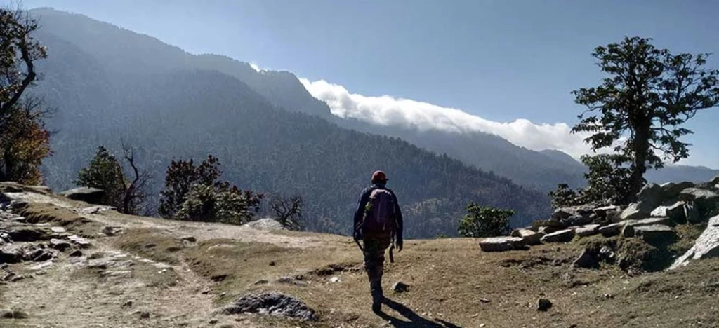
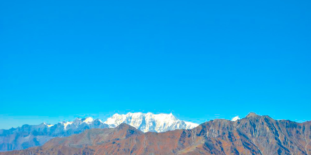
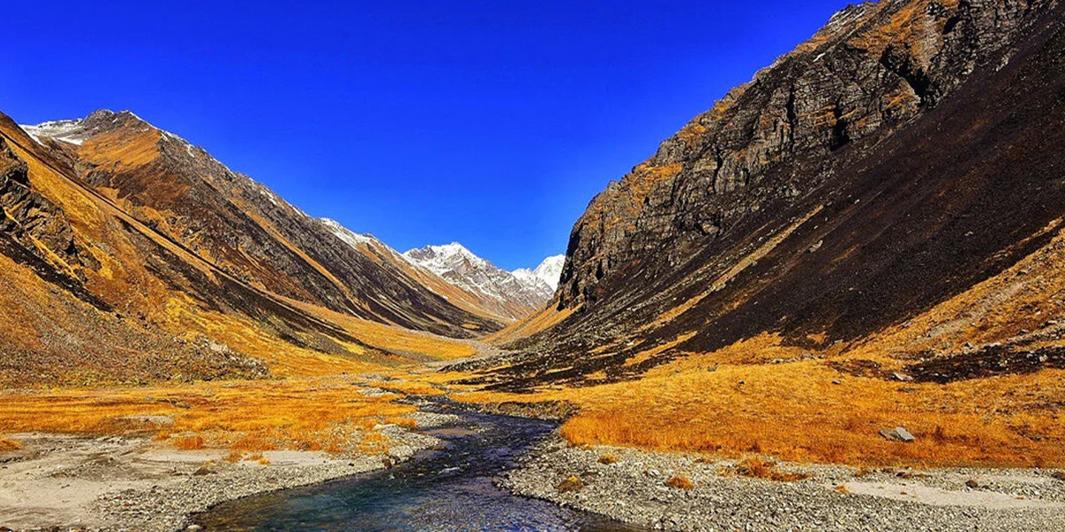
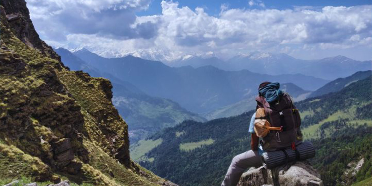
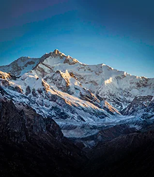
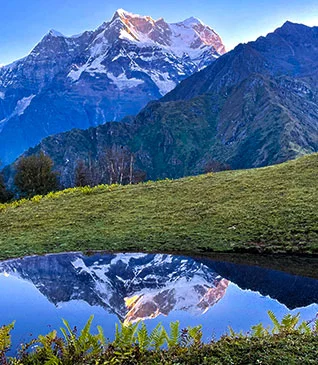
Many people dream of trekking in Uttarakhand alps of the mighty
Himalayas. Uttarakhand is a hilly state to a great extent, located at the
foothills of the Himalayan mountain ranges. The state is blessed with natural
resources - rivers, forests and most importantly snow-clad mountains. The most
revered Dhams in Uttarakhand are Hindu temples of Badrinath, Kedarnath,
Gangotri and Yamunotri are nestled in these ferocious mountains. Trekking is a
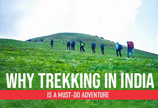
very popular sport in Uttarakhand due to its accessibility. From beginners to
experts, they can test their stamina by trekking these mountains. You can find
Treks in Uttarakhand from easy to difficult climb. To name a few -
Kedarkantha,
Valley of Flowers, and Bali Pass are
the most popular treks in Uttarakhand. Find your bucket list treks for
Uttarakhand below.
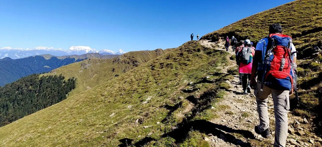
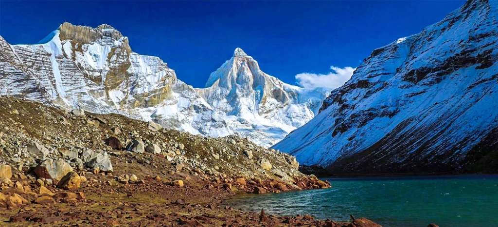
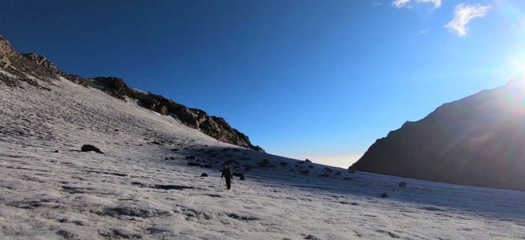
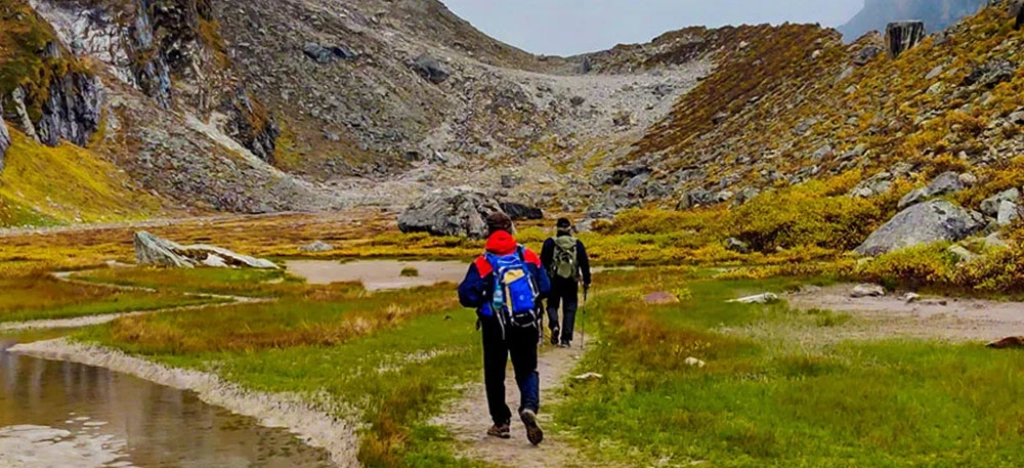
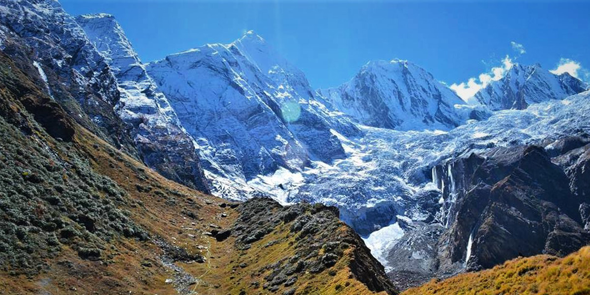
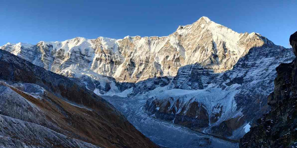
Often called the Queen of winter treks – Kedarkantha is the most mystical trail you can walk on. The towering pines are
covered with snow, a stairway to heaven with its enchanting beauty. The
kaleidoscopic sky with mesmerising views of sunrise and sunsets and the
awe-inspiring landscapes just make you speechless. Given that the Kedarkantha peak is located at an altitude of 12,500 ft. you have to walk in the snow to
reach the top. The beautiful scenery and easy trail make it the most popular trek in Uttarakhand.
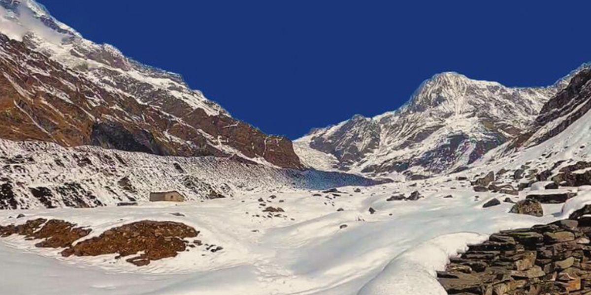
Brahmatal Trek
Region
Uttarakhand
Grade:
Easy to Moderate
Trek Distance:
24 km
Altitude:
12,200 ft
Best Season
Winter & Spring
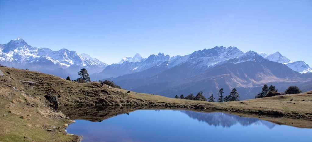
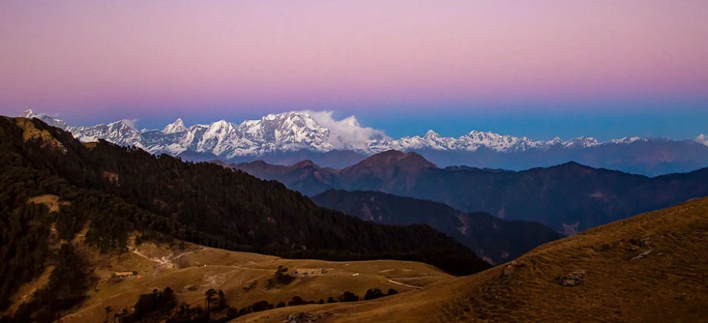
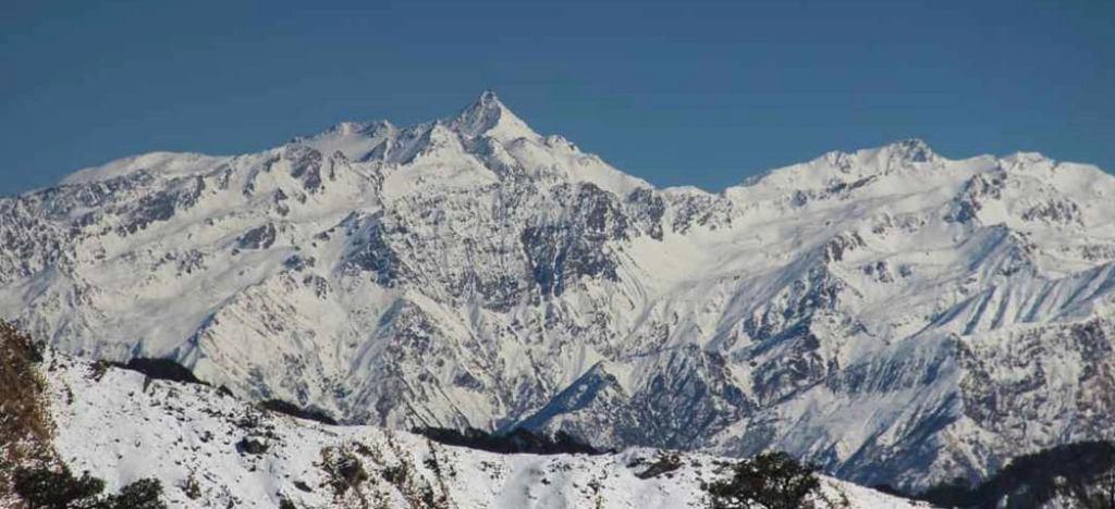
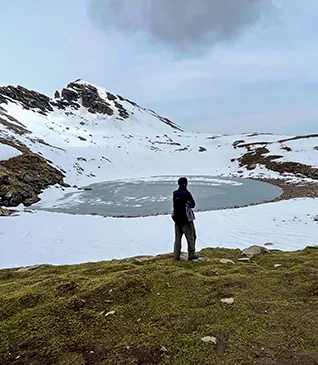
The serenity of alpine lakes is something one
should definitely experience once. No wonder these lakes used to be the
meditative spots for sages in ancient times. While most alpine lakes remain
closed during winter, the trek to Brahmatal takes you to two beautiful glacial lakes. In the depth of winter,
lies many mysteries and these frozen lakes add to
the mystical vibe. From the summit, you get to see beautiful vistas of Mt.
Trishul and Mt. Nanda Ghunti. It seems as if you can just reach out with
your hands and touch the snow-covered peaks, that’s how close they appear!
Har Ki Doon Trek
Region
Uttarakhand
Grade:
Easy to Moderate
Trek Distance:
44 km
Altitude:
12,000 ft
Best Season
Summer & Autumn
Har Ki Dun
is a cradle-shaped valley located at an altitude of 12000 ft. This exhilarating trek is a beautiful mix of ancient culture
and the allure of the mountains. Nestled in the nooks of the
Garhwal Himalayas, the Har Ki Dun
trail lets you experience the best of alpine beauty as you tread
along meadows, grasslands, forests, streams, and rivers. The
Swargrohini group of peaks. The Black Peak and Hata Peak serve as
the perfect backdrops to complement the beauty of the valley.
Kuari Pass Trek
Region:
Uttarakhand
Grade:
Moderate
Trek Distance: 27 km
Altitude:
12,750 ft
Best Time:
Winter and Spring
Kuari Pass trek, also known as the Curzon’s trail, is a mesmerizing
journey through the beautiful Himalayan landscapes. The trek
begins from Tugasi village, and takes you through the enchanting
Tali forest and Gorson Bugyal. The trail takes you through the
Nanda Devi Sanctuary, where you can witness a rich
biodiversity.
During the winters, the trek is even more enchanting with snowy
vistas and crispy winter air. The highlight of the trek is the
360 degree panoramic view of the famous Himalayan peaks
like, Chaukhamba, Dronagiri, Neelkanth and many more from the
vantage point.
Chopta Chandrashila Trek
Region
Uttarakhand
Grade
Easy to Moderate
Trek Distance
30 km
Altitude
12,100 ft
Best Season
Summer, Winter, Autumn &
Spring
Chopta Chandrashila
is another scenic journey that takes you to the peak of
Chandrashila, from where you can witness a
360-degree panoramic view of the Himalayas. The trek
includes four scenic destinations, Deoriatal, Rohini Bugyal,
Tungnath and Chandrashila.
The trekking trails begin from the Sari village taking you
to the most photogenic place Deoriatal, then passing through
Rohini Bugyal you get to camp amid the scenic vistas. Then
another part of the trek begins from the hamlet of Chopta
and takes you through Tungnath which is considered to be the
highest Shiva temple in the world to the
Chandrashila peak, from where you can spot peaks like Nanda Devi, Trishul
and Chaukhamba.
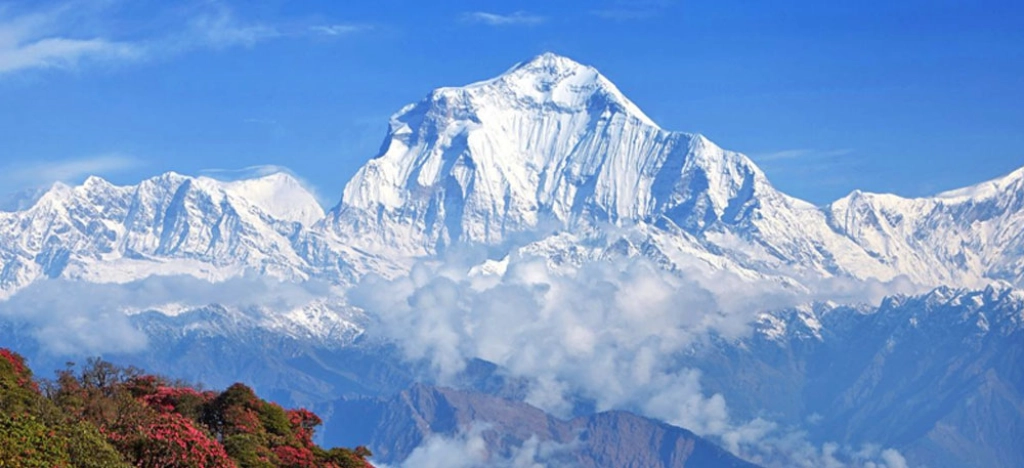
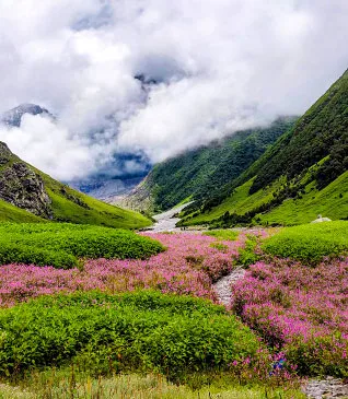
Valley Of Flowers Trek
Region
Uttarakhand
Grade
Easy to Moderate
Trek Distance
37 km
Altitude
14,100 ft
Best Season
Autumn & Monsoon
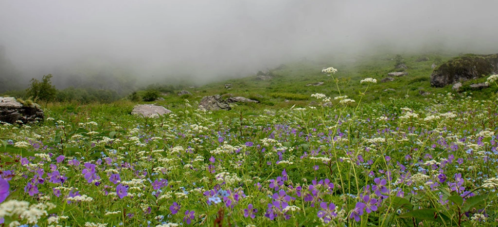
The valley was first discovered accidentally by a group of
mountaineers in 1931 who were returning from an expedition to Mount
Kamet. Frank Smythe, Eric Shipton and RL Holdsworth were a part of
this team. In 1980, Valley of Flowers was declared a national park and in 2000, Nanda Devi
Biosphere Reserve added it as the second core zone. It now comes
under UNESCO’s
Man and the Biosphere (MAB) programme. There are about 500
varieties of flowers that are found here and some of them even
have medicinal properties.
Dayara Bugyal Trek
Region
Uttarakhand
Grade
Easy to Moderate
Trek Distance
22 km
Altitude
12,100 ft
Best Season
Summer, Winter, Autumn &
Spring
A rambling walk through the undulated pastures of Dayara Bugyal will bring you out of the world frames of its green
ecosystem, the whispering wilderness of the oak woods, and
somewhere far away, a breathless panoramic view of the peak
gradually unfolding. At different junctures, you can catch
glimpses of the Gangotri set of peaks, Srikanth Peak, Bandarpoonch, and Black Peak. It is an excellent choice for beginners.
Pindari Glacier Trek
Region
Uttarakhand
Grade
Moderate
Trek Distance
50 km
Altitude:
12,300 ft
Best Season
Summer & Autumn
The Kumaon region of the Himalayas is blessed with an abundance of
natural beauty and this trek offers varied natural splendours all
along the trek. Pindari Glacier lies at the edge of Nanda Devi Peak and the Zero point takes you to an astounding altitude of
3660 metres. This is one of the most easily accessible glaciers in
our country and is suitable for anyone who wishes to do the trek.
Throughout the trek, you will pass through Rhododendron forests,
lush meadows, green valleys, and cascading rivers to
the Pindari Glacier summit, where you are
welcomed with the spellbinding views of Nanda Devi Peak. This is one of the most beautiful treks that will leave you
speechless with its incredible scenery.
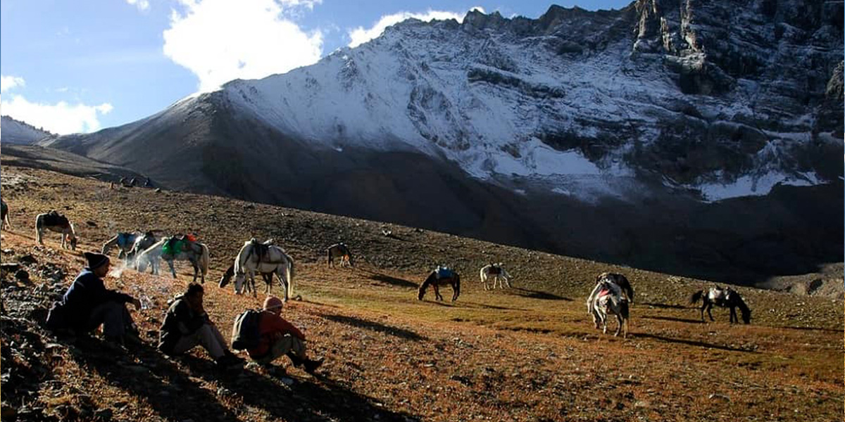
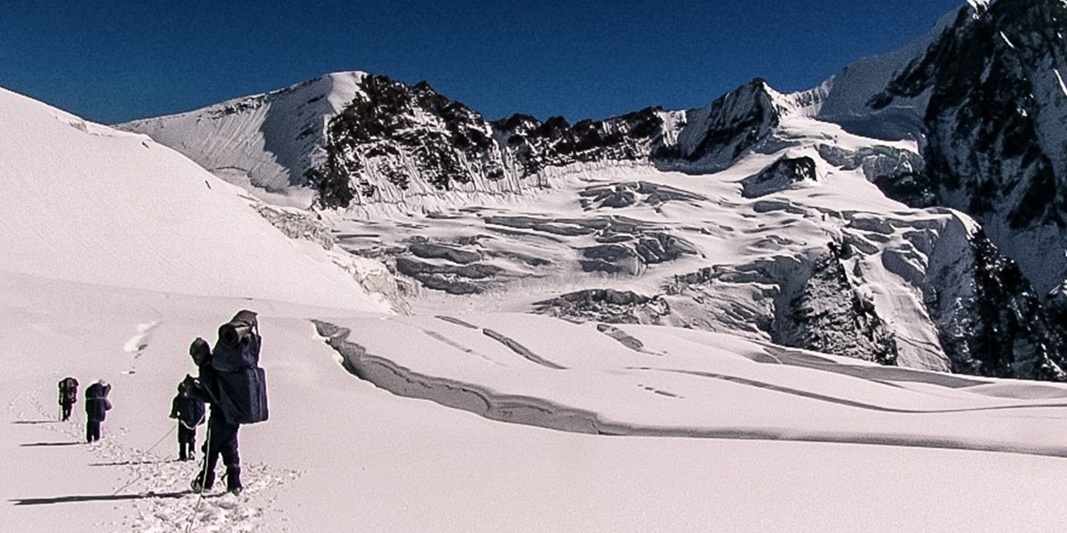
Bagini Glacier Trek
Region
Uttarakhand
Grade
Moderate
Trek Distance
43 km
Altitude
14,800 ft
Best Season
Summer & Autumn
Bagini Glacier
is located in the Nanda Devi National Park and the trek to Bagini
Glacier takes you through rocky terrains, beautiful mountain
hamlets, clear water streams and even rushing cold rivers. The
trek is 9 days long and filled with beautiful views and thrilling
adventure. The trek route offers you beautiful views of the
surrounding mountains and passes through villages, meadows and
glaciers. It is a slightly challenging trek with steep and a
little slippery trails, but the views make up for it.
Auden’s Col Trek
Region
Uttarakhand
Grade
Difficult
Trek Distance
95 km
Altitude
18,000 ft
Best Season
Summer
Auden's Colis a thrilling adventure that takes you through beautiful
meadows and crystal clear lakes. It is named after John Bicknel
Auden who discovered the pass. The expedition trek also has a
spiritual significance since it connects the two of Char Dham,
Gangotri and Kedarnath. It has challenging terrains with steep
ascents and rocky terrains, the knee-deep snow makes the trails
a bit more challenging. The trek is considered tough, but each
challenge opens up to remarkable views. The Auden’s Col trek
allows you to experience Himalayas in their raw form and has all
the elements of a good Himalayan trek.
Binsar Trek
Region
Uttarakhand
Grade
Easy
Trek Distance
22 km
Altitude
8,100 ft
Best Season
Autumn & Spring
Binsar Trek
is a short yet beautiful trek, you can do it on any weekend
since it can be done in just two days. It is nestled in the
Almora district and offers you an enriching experience of
exploring the Binsar Wildlife Sanctuary. The sanctuary is home
to a wide variety of flora and fauna. The trek route traverses
through forests and villages, giving you an opportunity to
witness the village life and traditions. If you are seeking a
quick and enriching adventure then Binsar Trek is the perfect
getaway for you.
The short trek will surely relish you with its fresh air and
majestic mountain views.
Ali Bedni Bugyal Trek
Region
Uttarakhand
Grade
Easy
Trek Distance
31 km
Altitude
11,350 ft
Best Season
Summer, Autumn & Spring
Ali Bedni Bugyal
is a beautiful trek to twin alpine meadows in the Chamoli
district. They are together known to be the largest alpine meadow
in Asia. You get to witness two vast meadows with majestic
mountain views in the background that will surely leave you
spellbound. The trek begins from Lohajung, taking you through
forests of Oak, Rhododendrons and maple. The meadows are lush
green with vibrant wildflowers adding to the beauty. The scenic
meadows create beautiful frames for photography. It is an easy to
moderate trek, that is indeed a rewarding one.
Panwali Kantha Trek
Region
Uttarakhand
Grade
Moderate
Trek Distance
40 km
Altitude
10,800 ft
Best Season
Autumn & Spring
Panwali Kantha
is a mystical meadow trek in the Garhwal Himalayas. It offers
you beautiful views of the Char Dham mountain ranges and you can
also get a closer view of other mountain peaks like Chaukhamba
and Neelkanth. The trek is rich in flora and fauna and you can
witness a wide range of biodiversity. The best time to do this
trek is during spring when the skies are clear, meadows are lush
green and trails are colorful with flowers blooming.
It is a moderate level trek that might become a bit difficult
during the winters with snow-laden trails.
Panch Kedar Trek
Region
Uttarakhand
Grade
Moderate to Difficult
Trek Distance
130 km
Altitude
13,000 ft
Best Season
Summer, Autumn & Monsoon
Panch Kedar Trek
is a mix of trek and drive to five different temples dedicated to
Lord Shiva and considered sacred according to Hindu mythology.
These five temples are Tungnath, Madhyamaheshwar, Kalpeshwar,
Kedarnath and Rudranath. All five temples are believed to have
relevance from the famous Hindu epic Mahabharata. Apart from being
a pilgrimage site, the journey is a mix of challenging and easy
treks giving you a memorable experience. It is a 12-day journey
that takes you through various terrains including forests full of
mighty trees and rocky terrains. Being an adventure lover, one
must not miss this journey full of adventures and beautiful
vistas.
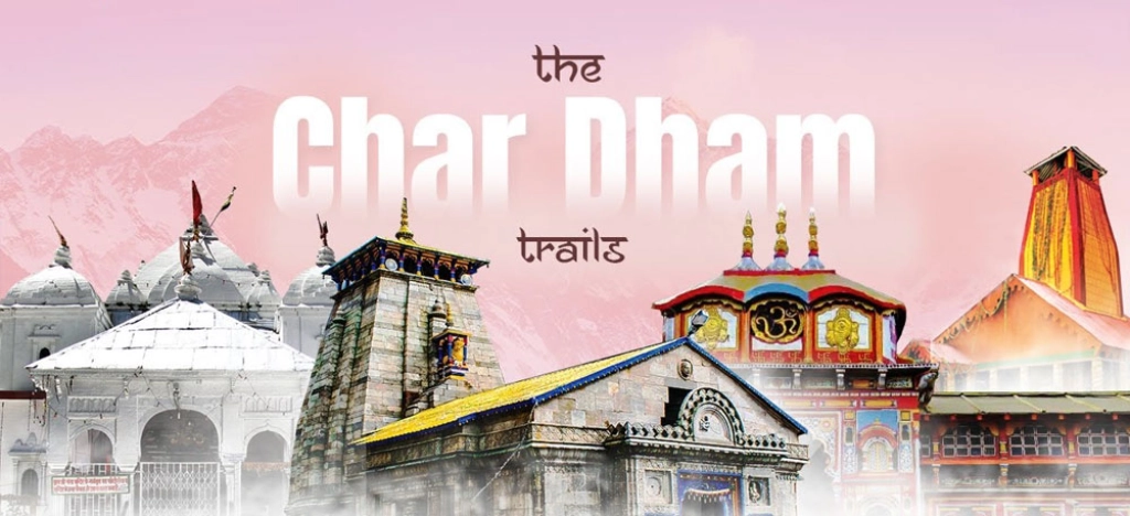
Chardham Yatra Package
Region
Uttarakhand
Grade
Easy to Moderate
Trek Distance:
48 km
Altitude
11,650 ft
Char Dham is another trek package with a mix of trek and
drive. It is a journey that combines visits to four sacred
temples Kedarnath, Badrinath, Gangotri and Yamunotri. The
journey begins from Haridwar taking you to Yamunotri by drive,
then Gangotri, then to Kedarnath by trekking and finally
Badrinath. The journey altogether is full of learning and
beautiful views.
All together these four sites together are known as Char Dham,
and are situated in The Garhwal Himalayas. You can get beautiful
views of the other mountain ranges from these sites, especially
from Kedarnath that is comparatively a longer trek. It is a
serene experience visiting these sites situated among high
mountains.
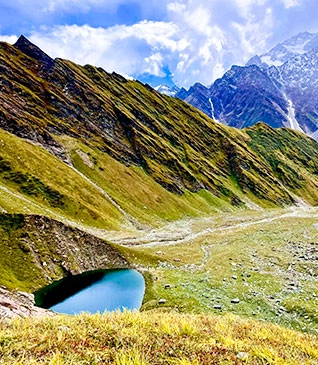
Kedartal Trek
Region
Uttarakhand
Grade
Moderate to Difficult
Trek Distance
37 km
Altitude
15,500 ft
Best Season
Summer & Autumn
If you have done a few
treks in the Himalayas
and are looking to push a little more, then
Kedartal
might just be the ideal one for you. It is considered a
difficult trek because of the rocky terrains but it is
definitely a beautiful journey. The trek leads you to a
high-altitude emerald lake, in the foothills of the
Himalayas.
The serene lake is surrounded by Mt. Thalay Sagar, Manda Parvat,
Mt. Bhrigupanth, Mt. Jogin and Mt. Gangotri. The lake looks even
more beautiful and picturesque when it reflects the surrounding
mountains. The trek begins from Gangotri and includes traversing
through varied landscapes from rocky terrains to beautiful
meadows, and charming forest.
Phulara Ridge Trek
Region
Uttarakhand
Grade
Easy to Moderate
Trek Distance
30 km
Altitude
12,150 ft
Best Season
Summer, Autumn & Spring
Phulara Ridge
is a beautiful and lesser known trek in the Uttarkashi district.
The trek begins from Sankri, and allows trekkers to trek
along a ridge, offering a continuous clear view of the mighty
Himalayas. It offers trekkers a wide range of biodiversity
including eye-catching and vibrant flowers and various animals.
The highlight of the trek is Pushtara meadows, grand and beautiful
meadows that will surely leave you stunned.
Bagji Bugyal Trek
Region
Uttarakhand
Grade
Easy
Trek Distance
25 km
Altitude
11,100 ft
Best Season
Summer, Autumn &
Spring
Bagji Bugyal
is an offbeat trek in Chamoli district, it is a beautiful
meadow trek. It is named after tigers, known as Bagh in local
language. According to locals it is believed that tigers used to
live in these meadows, but now they have disappeared.
Bagji Bugyal is a very lesser known trek, yet a beautiful one.
It gives you beautiful views of the surrounding peaks like Nanda
Ghunti and Mrigthuni. The trek begins from Ghase, a serene
Himalayan hamlet taking you through forest to an expansive high
altitude meadow. During the winter months, the trek is
even more beautiful with sheets of snow, glistering in the
sunlight.
Rudragaira Peak Expedition Trek
Region
Uttarakhand
Grade
Difficult
Trek Distance
50 km
Altitude
19,080 ft
Best Season
Summer & Autumn
Mt. Rudugaira
is located in The Rudu valley of Garhwal Himalayas, and has a
beautiful view of the surroundings. The Rudugaira peak expedition
is considered to be difficult, yet safer than other treks. It is
an ideal trek, if you already know about mountain climbing and
want to raise your bars further. The trek begins from Gangotri,
taking you to the summit. The trek will also require technical
knowledge and loading ferries.
Mayali Pass Trek
Region
Uttarakhand
Grade
Difficult
Trek Distance
90 km approx.
Altitude
16,890 ft
Mayali pass
is a beautiful trek in the Garhwal Himalayas, it is the pass
between Marsar and Vasuki lake. It offers you a closer and
beautiful view of major peaks like Kedar Dome and Chaukhamba.
The serene and isolated landscapes through the trek help you
connect with yourself and spending time in the beautiful natural
vistas here makes you feel relaxed. The trek requires a good
level of physical fitness and also gives you a good experience
of village life in the mountains.
Mukta Top Trek
Region
Uttarakhand
Grade
Easy
Trek Distance
28 km approx.
Altitude
11,820 ft
Mukta Top is an excellent trek located in
Uttarkashi district. The maximum altitude of this trek is 11,800
ft. It is a stunningly
isolated trekking trail which takes you
through lovely meadows diverse with wildlife, staggering mountain
views and a thrilling summit. This is a perfect offbeat trek for
beginners as well as experienced trekkers. In winter the
landscapes of this trek are filled with a thick blanket of snow
making it even more enjoyable. From the summit you can witness the
mesmerising beauty of Bandarpoonch, Kalanag, Gangotri, Jaonli and Nag Tibbapeaks.
Dodital Trek
Region
Uttarakhand
Grade
Easy to Moderate
Trek Distance
49 km
Altitude
13,600 ft
Best Season
Summer & Autumn
Dodital-Darwa Pass trek takes us into the interior forestscapes of Assi Ganga Valley. This trek offers an amazing escapade into the deep jungles of
Uttarkashi. The idyllic 40 Km trek starts from Agoda village to a
crystal green Dodital lake at 3024m and further up to Darwa Pass soaring at 4151m. It is a freshwater lake that is a primary
source for the Assi Ganga River
that merges downstream with Bhagirathi. This lake is semi-frozen
during winters with a white sheet of powdered snow covering its
surrounding trees and thick foliage. The trail leading to the lake
is blessed with astounding views of mountain villages and lush
green surroundings.
Chirbatiya Trek
Region
Uttarakhand
Grade
3 Days
Trek Distance
13 km approx
Altitude
9,100 ft
Chirbatiya is a beautiful weekend trek located in the Rudraprayag district of Uttarakhand. The
trek starts from Chirbatiya, which is a small hamlet on the Ghansali-Mayali road and is
perched at an elevation of 2134 mts. The entire village
of Chirbatiya is covered densely with Rhododendron, Oak, and Deodar
forests. There’s also a gushing waterfall that makes the place
even more charming. You will also get to see terrace farming as
the people in the village follow this type of farming. The quaint
village of Chirbatiya
is a peaceful respite away from the hustle and bustle of city
life.
Dharansi Pass Trek
Region
Uttarakhand
Grade
Moderate
Trek Distance
55 km
Altitude
13,980 ft
Located in the Chamoli District of Uttarakhand, Dharansi Pass is your closest encounter with the restricted Nanda Devi
Sanctuary and you get to see the second-highest mountain in India
from up close. The Sanctuary is surrounded by
majestic Himalayan peaks including Dunagiri
(7,066 m), Bethartoli (6,352 m), Mt Trishul (7,120 m), Mt. Nanda
Devi (7,817 m), and Mt. Nanda Devi East (7,430 m). One can also
witness the diverse flora and fauna of the region. The pass is
located at an altitude of 4,915 m and is a wonderful journey
amidst alluring mountains and the magnificence of nature. This
offbeat trail is a must-do for those who do not shy away from
challenging themselves to explore the thrill of the unknown.
Satopanth Lake Trek
Region
Uttarakhand
Grade
Moderate
Trek Distance
50 km
Altitude
14,270 ft
Best Season
Summer & Autumn
Set at an elevation of 4600 m above sea level, Satopanth is a crystal clear emerald lake located in the Garhwal
Himalayas. Surrounded by snow-clad mountains on all sides, the
lake’s setting fills you with immense tranquillity. The trek is
becoming quite popular in recent times and is known for its
religious significance and grand mountain views. Satopanth lake
is triangular in shape and can be easily accessed from Lakshmi Van
near Badrinath. The lake is not the only attraction of the trek
but the trail itself passes through many scenic wonders. The trail
goes through Mana Village, which is the last village in India and
you will also cross two beautiful waterfalls – Sahastradhara and
Vasudhara.
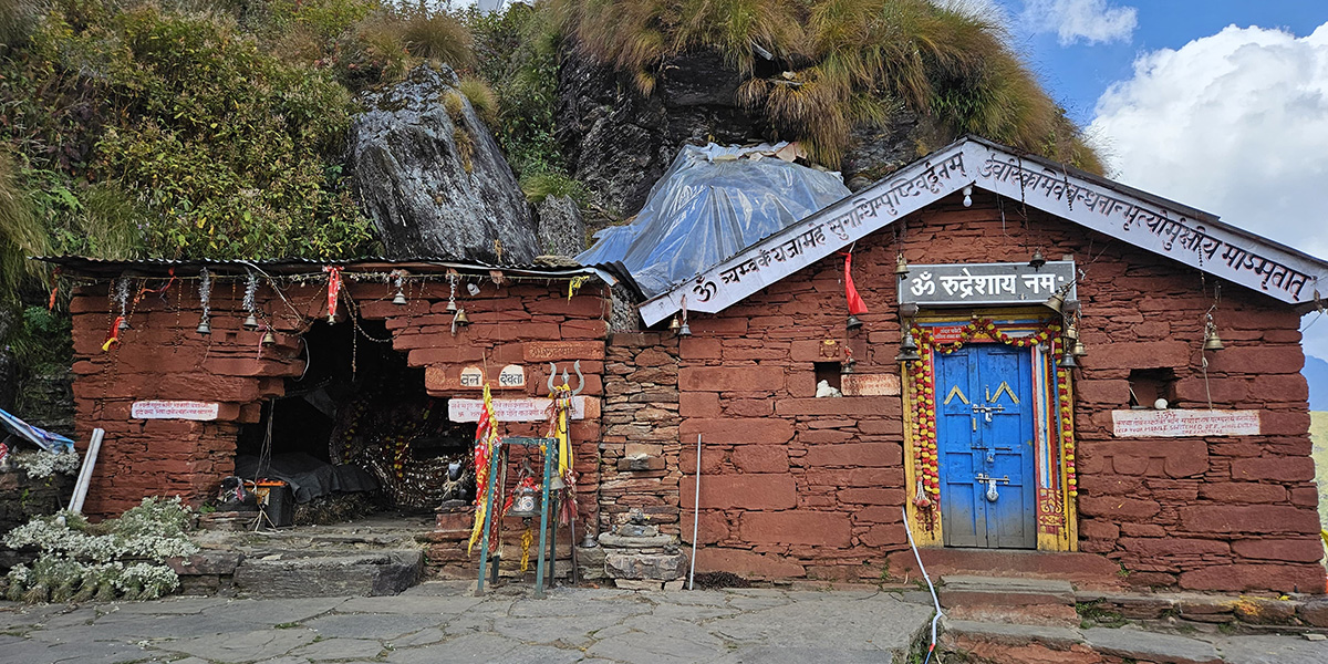
Kalpeshwar Rudranath Trek
Region
Uttarakhand
Grade
Moderate
Trek Distance
62 km
Altitude
11,810 ft
Kalpeshwar and Rudranath are two of
the Panch Kedars. The Kalpeshwar-Rudranath Trek route is one of the less-frequented trekking routes and as
such the natural beauty is intact in this trail. The trail passes
through remote Himalayan hamlets and picturesque mountain
panoramas. Kalpeshwar is the last of
the Panch Kedars and is the easiest to reach while Rudranath
is the fourth and the hardest to get. Trek along a beautiful route
with the Alaknanda River sculpting her way down the plains, the
verdant green valleys between Gopeshwar and Mandal, and
breathtaking views of Nanda Devi, Nanda Ghunti, and Mt. Trishul.
Embark on this beautiful journey that will give you the perfect
dose of adventure and spiritual bliss.
Milam Glacier Trek
Region
Uttarakhand
Grade
Moderate
Trek Distance
58 km approx.
Altitude
7,510 ft approx.
Milam Glacier is a remote yet accessible Glacier
in Uttarakhand located approximately at an altitude of 7515 ft.
Located in the Kumaon region, this glacier is the source of the
Gori Ganga River, a tributary of the Pindar River. About 60 km
from Munsiyari, this trek offers a panoramic view of the Himalayan
Ranges like Hardeol Peak (7,151 m), Deo Damla (6,637 m), Mangraon
(6,568 m), and Sakram peak (6,254 m). It is a scenic trek that
takes you along lush green meadows, mesmerising pine forests,
waterfalls, streams, and some of the most isolated settlements in
the Kumaon Himalayas.
Panchachuli Base Camp Trek
Region
Uttarakhand
Grade
Easy to Moderate
Trek Distance
60 km approx
Altitude
13,970 ft approx.
Located in the Darma Valley of Pithoragarh, Panchachuli Base Camp Trek is snuggled in the lap of the snow-laden Himalayas. The
trek is adorned with nature’s splendour and along the trail, you
can see cascading waterfalls, and stunning vistas with snow-capped
peaks all around. Throughout the trek, you will walk by the
Dhauliganga River and the trail entwines along many tribal
villages like Sela, Bongling, Baaling, Nagling, and Duktu. The
thick forests of Bhoja Patra and Deodar with a stunning backdrop
of the Himalayas are one major highlight of the trek and if you
are lucky, you can spot some rare bird species in these forests.
The Panchachuli Base Camp is nothing short
of a feast to the eyes and the scenery throughout the journey to
the base camp is something that needs to be experienced and cannot
be explained with words!
Nanda Devi East Base Camp Trek
Region
Uttarakhand
Grade
Difficult
Trek Distance
54 km approx.
Altitude
12,970 ft approx.
Nanda Devi, undoubtedly, is one of the most
gorgeous peaks in our country and a trek to the Base Camp of Nanda Devi East takes you on a resplendent journey in the midst of an
exotic Himalayan biosphere. You might spot rare Himalayan species
like Black Bear, leopard, Himalayan Tahr, Bharal and Snow Leopard
and also spot a rich biodiversity of birdlife. The Trek takes you
through the eastern facet of the Nanda Devi Peak, which also houses the Panchachuli Glacier. Trekking through the deserted
villages near Munsiyari and Milam, you will get a close peek into
their culture and traditions. Get to witness astounding views
of Nanda Devi (7,816 m), Trishul (7,074 m), Panchachuli Peaks and Nanda Kot (6,861 m) along the way. A stunningly beautiful yet arduously
challenging trek, the Nanda Devi East Base Camp trek
calls to all the passionate trekkers, who know how to push their
limits.
Khaliya Trek
Region
Uttarakhand
Grade
Easy
Trek Distance
15 km approx.
Altitude
11,480 ft approx.
Khaliya Top is a beautiful meadow trek
surrounded by galvanising Himalayan peaks.
This trek beautifully presents the mesmerising beauty of the
Kumaon region. Situated at an altitude of 3500 metres above sea
level the summit offers a stunning gallery of peaks like
Rajrambha, Hardeol, Panchachuli and Nanda Kot. The summit views
are what this trek is popular
for. Khaliya Top also serves as a base
for winter sports like skiing and paragliding in summer. In the
springtime, the trail is a gorgeous serenade of red with the
Rhododendrons in full bloom. If you are someone who loves
wildlife, this trek is a great location to spot animals like
Bharals (Himalayan Mountain Goat), and birds like Monal, Yellow
Fronted Marten, Kakar, and Ghurar. It is a beginner-friendly trek
and is ideal for anyone who is looking for a short trek into the
mountains.
Ralam Dhura Pass Trek
Region
Uttarakhand
Grade
Difficult
Trek Distance
95 km approx.
Altitude
18,470 ft approx.
Perched at a stunning elevation of 5,630 ft, Ralam Dhura Pass is a beautiful offbeat trek
for adventure enthusiasts. The trek is
a tough yet adventurous journey through the beautiful Kumaon
Himalayas. The pass connects the Ralam Valley with the Darma Valley and the trek
can be done between April to June and September to November. In
winter, there is heavy snowfall which is why one cannot cross the
pass. En route to the pass, you will cross three beautiful
glaciers Sutela, Kalaban, and Yangchar Glacier. If you are
looking for a challenging trail to get a good dose of adrenaline,
this is your place to be!
Anta Dhura Pass Trek
Region
Uttarakhand
Grade
Difficult
Altitude 16,070 ft approx.
A crossover pass that traverses from the Garhwal Region to
the Kumaon Region, Anta Dhura is located in the
very remotest corners of the Uttarakhand Himalayas. This
pass is encountered on the Milari-Milam Trek and is quite an offbeat
adventure.
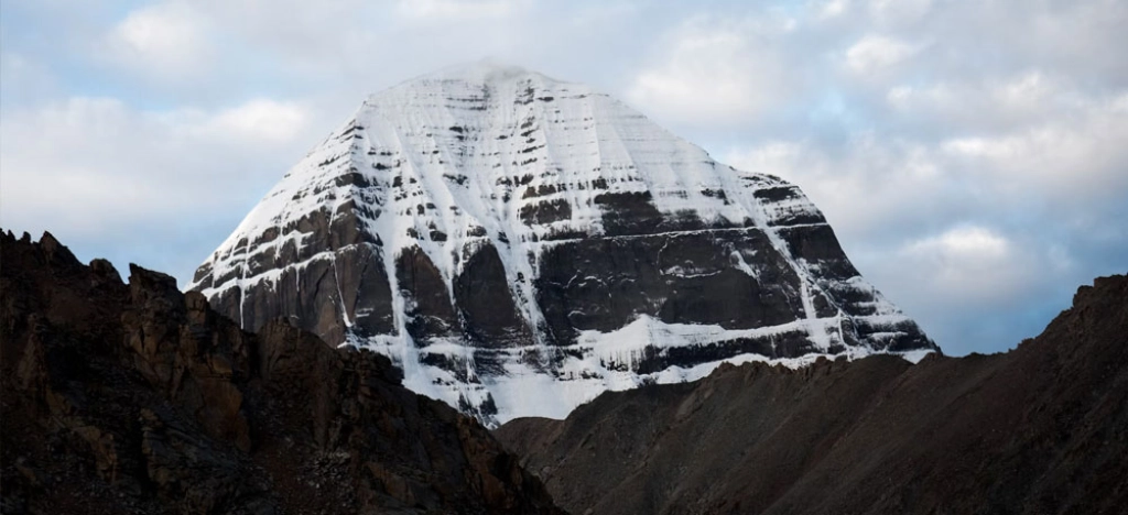
Adi Kailash and Om Parvat Trek
Region
Uttarakhand
Grade
Moderate
Trek Distance
86 km approx
Altitude
18,270 ft approx.
The Kumaon Himalayas are blessed with an abundance of
beauty and offer a number of offbeat trails for brave
wanderers.
Adi Kailash
and
Om Parvat
Trek is one such beautiful trek draped in a mystic mix
of adventure and mythology. As per Hindu mythology,
Adi Kailash is often considered the oldest abode of
Lord Shiva. The astounding part of the Om Parvat Trek
is the mysterious Om formation on the mountains caused
by the deposition of snow. This adds a religious
significance to the trek. During sundown, the sun
casts a shadow on the peak which also has a striking
resemblance to the Swastika symbol, an auspicious
mark. Om Parvat is located at the junction of three
countries India, Tibet and Nepal and the views of the
Himalayas from here are simply breathtaking.
Lipulekh Pass Trek
Region
Uttarakhand
Grade
Moderate to
Difficult
Trek Distance
100 km approx.
Altitude
17,500 ft approx.
A high-altitude mountain pass located in the Pithoragarh
district of Uttarakhand, Lipulekh Pass takes
you to an extraordinary vantage point at 5334 m. This is
an international mountain pass located in the junction
of India, Nepal, and China. The fabled Kailash
Mansarovar Yatra takes place through this pass. This
pass served as an important trading route in ancient
times and in recent times as well, it is open for
cross-border trade between June and September every
year.
Chipla Kedar Trek
Region
Uttarakhand
Grade
Moderate
Trek Distance
55 km approx.
Altitude
16,000 ft approx
One of the most challenging and adventurous trails in
Uttarakhand, Chipla Kedar Trek is not for
the faint-hearted. The trek takes you to an altitude of
5,200 m and offers scenic views of some of the most
beautiful high-altitude meadows and Himalayan
peaks. The main attraction of the trek is the Chipla
Kund or Chipla Lake at 16,000 ft. The trail is not just
replete with natural beauty but is also a great spot for
wildlife spotting. You can spot a diverse range of birds
and animals like The Himalayan Musk Deer, Bharal, Thar,
Wild Goat, and even Snow Leopards. Birds like
Yellow-throated Marten, Monal, Western Tragopan, Pika,
Khaleej Pheasant, Spotted Dove, Griffon, and Rock Pigeon
can also be spotted. Every two years, Chipla Kedar
sees a festive gathering, where people from nearby 40
villages gather with Bhankaras (metallic pipe
instruments), and drums and they travel to Chipla
Kedar in a pilgrim journey. While this is not a
commercially popular trek, it is an extremely rewarding
one!
Namik Glacier Trek
Region
Uttarakhand
Grade
Easy To Moderate
Trek Distance
81 km approx
Altitude
11,810 ft approx
A beautiful glacier in the Pithoragarh district of
Uttarakhand, Namik Glacier is perched
at an altitude of 3,600 m and stretches over a distance
of 3 km. The glacier is the source of the Ram Ganga
River and offers a beautiful vista of Himalayan
Peaks like Nanda Kot (6,861 m), Nanda Devi (7,848 m),
and Trishul (7,120 m). The name Namik means “saline
waters”, which is true to the characteristic of the
glacier. A number of waterfalls and sulphur springs
originate from the glacier. The trek takes you into the
isolated wilderness of the Kumaon Himalayas with
extremely attractive surroundings. The trek is ideal for
anyone who loves nature and is looking for an offbeat
adventure!
Darma Valley Trek
Region
Uttarakhand
Grade
Moderate to
Difficult
Trek Distance
60 km approx.
Altitude
11,380 ft
Situated at an altitude of 3470m, the Dharma Valley in Pithorgarh region, is the ideal getaway
destination for nature lovers and those looking to
escape the cacophony of everyday life. The valley shaped
by the Dharma River is home to 12 tribal villages.
The difficulty of this trek is moderate to difficult but
is equally rewarding with its picturesque landscapes,
waterfalls and calm enchanting mountains. There is a
location in the trek where you have to cross towering
glaciers which is challenging but the spectacular
scenery makes the journey so worthy of all the
challenges.
Brij Ganga Pass Trek
Region
Uttarakhand
Grade
Moderate
Trek Distance
25 km approx.
Altitude
15,300 ft
Brij Ganga Pass at a height of 4666m is one
of the best places to take in the enchanting beauty of
the surrounding Himalayan Valleys in all of
Uttarakhand. One can view the entire Nanda Devi range of
Peaks from this pass. This adventurous trek follows a
few parts of the old trading route to Tibet following
the Gori Ganga River. From the roadhead, beyond
Munsiyari, one follows a well-defined trail along a
narrow valley to the village of Milam.
Kafni Glacier Trek
Region
Uttarakhand
Grade
Moderate to
Difficult
Trek Distance
85 km approx
Altitude
12660 ft
Located in the Bageshwar, Kumaon region in Uttarakhand,
lies a small glacier called Kafni Glacier. It is
the main source of the Kafni River and Pindar
River’s tributary which later joins the
Ganges. Kafni Glacier is situated on the left
side of Pindar Valley, beneath the famous peak of
Nandkot and to the southeast of Nanda Devi Peak.
This is a well-known trek for adventure lovers.
Experience the multi-coloured flowers of Rhododendron,
which will make for an enjoyable journey to Kafni Glacier Trek.
Sunderdhunga Trek
Region
Uttarakhand
Grade
Moderate to
Difficult
Trek Distance
60.5 km approx
Altitude
12,510 ft
Sunderdhunga Trek follows
river Sunderdhunga upstream from Khati
village until its origin. The most beautiful trek
among its two neighbouring treks
i.e. Pindari and Kafni glacier treks. The
trail takes you through the remote regions, exotic
villages, glaciers and pristine meadows. The snow-capped
peaks like Mrigthuni, Maiktoli, Panwalidwar and Tharkot
are distinctly visible from this trek. If you wish to
explore the natural splendours of the Himalayas, this
trek is a must-visit.
Traill’s Pass Trek
Region
Uttarakhand
Grade
Difficult
Trek Distance
100 km approx.
Altitude
17,720 ft
A stunning high-altitude pass named after George William
Traill, Traill’s Pass Trek is a beautiful
high-altitude pass that sits at the head of Pindari Glacier, linking the valleys of Lawan and Pindari. Flanked by
Mt. Nanda Devi on one side, and Nanda Kot on
the other, the pass segregates the Kumaon and Garhwal
regions of the Himalayas. The rivers Pindar and Gori
Ganga originate from the glaciers Pindari and Lawan Gad
respectively, gracing the sides of Traill’s pass. The
majestic peaks of Garhwal Himalayas, including the
massive Nanda Devi peak stand watching you over
throughout the expedition.
Chirbatiya is a beautiful weekend trek located in
the Rudraprayag district of Uttarakhand. The trek starts
from Chirbatiya, which is a small hamlet on the
Ghansali-Mayali road and is perched at an elevation
of 2134 mts. The entire village of Chirbatiya
is covered densely with Rhododendron, Oak, and Deodar
forests. There’s also a gushing waterfall that makes the
place even more charming. You will also get to see
terrace farming as the people in the village follow this
type of farming. The quaint village of Chirbatiya
is a peaceful respite away from the hustle and bustle of
city life.
Binsar Weekend Trek
Region
Uttarakhand
Grade
Easy
Trek Distance
22 km
Altitude
8,100 ft
Best Season
Summer, Winter, Autumn
& Spring
A beautiful hill station in Almora, Uttarakhand,
the Binsar trek gives you stunning views of the Kumaon region.
The beautiful Himalayan stretch also gives some
wonderful views of Chaukhamba Peak, Trishul
Peak, Kedarnath, Panchachuli, Nanda
Devi and Nanda Kot. Traverse through forests
of Oak, Pine, Firs and Deodars and appreciate the alpine
beauty. You may also spot some rare bird species here.
Trek through gorgeous passages absorbing the beauty of
the scenic surroundings and some of the best mountain
views from the top. The regal Himalayas are filled with
profound natural beauty.
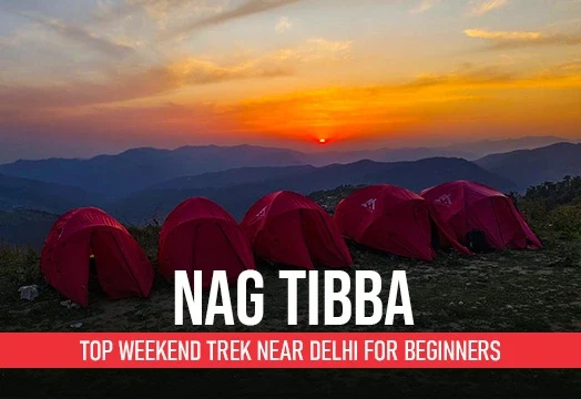
Nag Tibba Trek
Region
Uttarakhand
Grade
Easy
Trek Distance
16 km
Altitude
9,900 ft
Best Season
Summer, Winter Autumn &
Spring
Set at an altitude of 3022 metres, the Nag Tibba Trek is a perfect weekend trek for you and
your family. The easy-moderate trek takes you to
the Nag Tibba summit, which is the highest point in the Garhwal Himalayas,
and as such earns you some rewarding views of the nearby
Himalayan Ranges. You can spot many Himalayan Ranges
like the Bandarpoonch, Kedarnath, Gangotri, and
Swargarohini Ranges, ChangBang peak, Black Peak,
Srikanth & the beautiful Doon Valley in the
distance.
Deoban Trek
Region
Uttarakhand
Grade
Easy to Moderate
Trek Distance
20 km
Altitude
9,850 ft
Best Season
Summer, Winter, Autumn
& Spring
The essence of a weekend trek is that in less time
and less effort, one gets to encounter the entire
Splendidness of the Himalayas. From 3000 metres Deoban shows 55 big peaks including Nanda Devi,
Swargrohini, Bandarpoonch and the list goes on. The
beauty of the Uttarakhand mountains, a mix of pine and
oak trees can also be seen. The camping sites are
flawlessly blessed with amazing meadows. Surprisingly
the trail is covered with snow in winter which makes it
a thrilling winter trek.
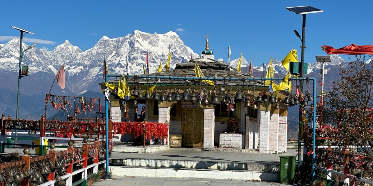
Kartikswami Trek
Region
Uttarakhand
Grade
Easy
Trek Distance
3 km
Altitude
10,000 ft
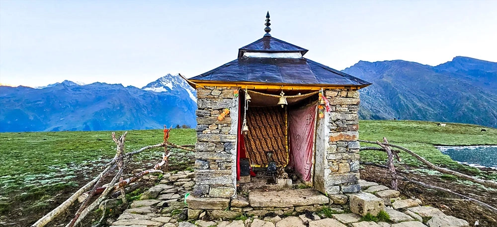
Kartikswami Temple lies in the serene
Garhwal mountains in Rudraprayag district of
Uttarakhand. The trek to Kartikswami
temple starts from Kanakchauri village in
Rudraprayag-Pokhari route. This temple belongs to Lord
Shiva’s elder son Kartikeya. It’s a natural stone-carved
idol of Kartik Swamy perched at an altitude of
3050mt adobe sea level.
The trail to Kartikswami temple is extremely
scenic, offering picturesque views of Snow-capped
mountains and pristine valleys.
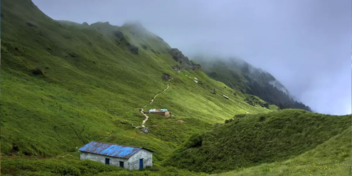
Kunjapuri Trek
Region
Uttarakhand
Grade
Easy
Trek Distance
9 km
Altitude
5500 ft
A temple
dedicated to the Hindu Goddess Sati is
Kunjapuri Temple. This trek is well-known as a
sunrise trek and runs all around the year. Winter season
is mostly preferred for this trek as the weather is
clear and pleasant. You come across the Neerghattu
waterfall enroute on this trek which flows in all
seasons. This trek makes it a perfect weekend trek for a
quick getaway from the hustle and bustle of the city.
.webp)
.webp)
.webp)
.webp)
.webp)
.jpg)
.webp)
.webp)
.webp)
.webp)
.webp)


.webp)